Area Overview for MK2 3AR
Photos of MK2 3AR
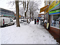
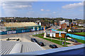
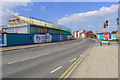
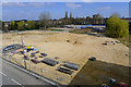
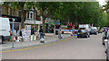
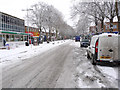
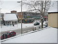
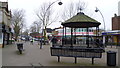
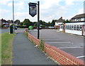
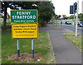
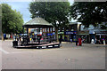
91 photos from this area
Area Information
Key information about the MK2 3AR including its size, population, and administrative classification.
- Area Type
- Postcode
- Area Size
- 2.7 hectares
- Population
- 1659
- Population Density
- 4850 people/km²
House Prices in MK2 3AR
38
Properties
£232,579
Average Sold Price
£82,500
Lowest Price
£360,000
Highest Price
Showing 38 properties
| Address | Type | Beds | Baths | Last Sale Price | Last Sale Date | |
|---|---|---|---|---|---|---|
| 26 Frensham Drive, Bletchley, MK2 3AR | Semi-detached | 4 | 1 | £340,000 | Nov 2024 | |
| 20 Frensham Drive, Bletchley, MK2 3AR | Semi-detached | 3 | 1 | £290,000 | Mar 2023 | |
| 34 Frensham Drive, Bletchley, MK2 3AR | Retail | 3 | 1 | £310,000 | Nov 2022 | |
| 30 Frensham Drive, Bletchley, MK2 3AR | Detached | 3 | 1 | £360,000 | Jul 2022 | |
| 50 Frensham Drive, Bletchley, MK2 3AR | Semi-detached | 3 | 1 | £290,000 | May 2022 | |
| 16 Frensham Drive, Bletchley, MK2 3AR | Retail | 3 | 1 | £325,000 | May 2022 | |
| 54 Frensham Drive, Bletchley, MK2 3AR | Semi-detached | 3 | 1 | £252,000 | Nov 2021 | |
| 70 Frensham Drive, Bletchley, MK2 3AR | house | - | - | £276,000 | Aug 2021 | |
| 18 Frensham Drive, Bletchley, MK2 3AR | house | - | - | £285,000 | Jun 2021 | |
| 48 Frensham Drive, Bletchley, MK2 3AR | Semi-detached | 3 | 1 | £215,000 | Sep 2020 |
Page 1 of 4
Energy Efficiency in MK2 3AR
Amenities
Schools
| Rank | School | Type | Entry gender | Ages |
|---|
Explore more schools in this area
Go to Schools tabDemographics
Household Size
Family (3-5 people)
most common
Accommodation Type
Houses
most common
Tenure
79
majority
Ethnic Group
White
most common
Religion
N/A
most common
Household Composition
N/A
most common
Age
47
median
Adults (30-64 years)
most common
Household Deprivation
N/A
with no deprivation
NS-SEC
27
in Lower managerial occupations
Explore more demographic insights in this area
Go to Demographics tabPlanning
Planning Constraints
- Flood RiskPremium
- Ramsar Wetland SitesPremium
- Area of Outstanding Natural BeautyPremium
- Protected Nature ReservePremium
- Protected WoodlandPremium