Area Overview for MK2 2HN
Photos of MK2 2HN
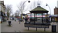
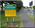
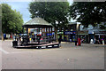
91 photos from this area
Area Information
Key information about the MK2 2HN including its size, population, and administrative classification.
- Area Type
- Postcode
- Area Size
- 7.9 hectares
- Population
- 1995
- Population Density
- 3990 people/km²
House Prices in MK2 2HN
84
Properties
£255,304
Average Sold Price
£53,750
Lowest Price
£433,000
Highest Price
Showing 84 properties
| Address | Type | Beds | Baths | Last Sale Price | Last Sale Date | |
|---|---|---|---|---|---|---|
| 20 Eaton Avenue, Bletchley, MK2 2HN | house | - | - | £300,000 | Jun 2025 | |
| 73 Eaton Avenue, Bletchley, MK2 2HN | Semi-detached | 4 | 1 | £420,000 | Mar 2025 | |
| 50 Eaton Avenue, Bletchley, MK2 2HN | Semi-detached | 3 | 1 | £400,000 | Jan 2025 | |
| 57 Eaton Avenue, Bletchley, MK2 2HN | Semi-detached | 4 | 1 | £433,000 | Jan 2025 | |
| 44 Eaton Avenue, Bletchley, MK2 2HN | Semi-detached | 3 | 1 | £325,000 | Feb 2024 | |
| 63 Eaton Avenue, Bletchley, MK2 2HN | Semi-detached | 4 | 2 | £420,000 | Oct 2023 | |
| 42 Eaton Avenue, Bletchley, MK2 2HN | Semi-detached | 3 | 1 | £348,250 | May 2023 | |
| 89 Eaton Avenue, Bletchley, MK2 2HN | Detached | 3 | 2 | £390,000 | Mar 2023 | |
| 74 Eaton Avenue, Bletchley, MK2 2HN | house | 3 | 1 | £380,000 | Nov 2022 | |
| 62 Eaton Avenue, Bletchley, MK2 2HN | Retail | 3 | 1 | £372,000 | May 2022 |
Page 1 of 9
Energy Efficiency in MK2 2HN
Amenities
Schools
| Rank | School | Type | Entry gender | Ages |
|---|
Explore more schools in this area
Go to Schools tabDemographics
Household Size
Family (3-5 people)
most common
Accommodation Type
Houses
most common
Tenure
61
majority
Ethnic Group
White
most common
Religion
N/A
most common
Household Composition
N/A
most common
Age
47
median
Adults (30-64 years)
most common
Household Deprivation
N/A
with no deprivation
NS-SEC
25
in Lower managerial occupations
Explore more demographic insights in this area
Go to Demographics tabPlanning
Planning Constraints
- Flood RiskPremium
- Ramsar Wetland SitesPremium
- Area of Outstanding Natural BeautyPremium
- Protected Nature ReservePremium
- Protected WoodlandPremium