Area Overview for MK19 7JT
Photos of MK19 7JT
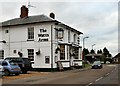
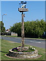
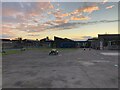
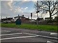
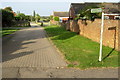
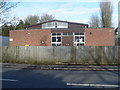

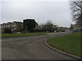
12 photos from this area
Area Information
Key information about the MK19 7JT including its size, population, and administrative classification.
- Area Type
- Postcode
- Area Size
- 4.2 hectares
- Population
- 1634
- Population Density
- 182 people/km²
House Prices in MK19 7JT
37
Properties
£319,271
Average Sold Price
£85,950
Lowest Price
£620,000
Highest Price
Showing 37 properties
| Address | Type | Beds | Baths | Last Sale Price | Last Sale Date | |
|---|---|---|---|---|---|---|
| 19 Kitelee Close, Hanslope, MK19 7JT | Detached | 4 | 2 | £590,000 | Apr 2025 | |
| 12 Kitelee Close, Hanslope, MK19 7JT | house | - | - | £620,000 | Dec 2024 | |
| 4 Kitelee Close, Hanslope, MK19 7JT | Detached | 4 | 2 | £477,000 | Jul 2024 | |
| 10 Kitelee Close, Hanslope, MK19 7JT | Detached | 4 | 2 | £590,000 | Oct 2023 | |
| 25 Kitelee Close, Hanslope, MK19 7JT | Semi-detached | 3 | 3 | £390,000 | Nov 2022 | |
| 17 Kitelee Close, Hanslope, MK19 7JT | house | - | - | £580,000 | Aug 2022 | |
| 3 Kitelee Close, Hanslope, MK19 7JT | Retail | 4 | 2 | £578,000 | Mar 2022 | |
| 6 Kitelee Close, Hanslope, MK19 7JT | house | - | - | £350,000 | Jun 2018 | |
| 13 Kitelee Close, Hanslope, MK19 7JT | house | - | - | £415,000 | Jun 2015 | |
| 1 Kitelee Close, Hanslope, MK19 7JT | Detached | 4 | 2 | £320,000 | May 2014 |
Page 1 of 4
Energy Efficiency in MK19 7JT
Amenities
Schools
| Rank | School | Type | Entry gender | Ages |
|---|
Explore more schools in this area
Go to Schools tabDemographics
Household Size
Two person
most common
Accommodation Type
Houses
most common
Tenure
70
majority
Ethnic Group
White
most common
Religion
N/A
most common
Household Composition
N/A
most common
Age
47
median
Adults (30-64 years)
most common
Household Deprivation
N/A
with no deprivation
NS-SEC
39
in Lower managerial occupations
Explore more demographic insights in this area
Go to Demographics tabPlanning
Planning Constraints
- Flood RiskPremium
- Ramsar Wetland SitesPremium
- Area of Outstanding Natural BeautyPremium
- Protected Nature ReservePremium
- Protected WoodlandPremium