Area Overview for MK18 5AE
Photos of MK18 5AE
Area Information
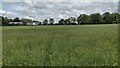
MK18 5AE is a small, compact residential area in England, spanning 24.7 hectares and home to 1,599 residents. With a population density of 48 people per square kilometre, it is a quiet, closely knit community. The area’s character is defined by its proximity to local amenities and educational institutions, making it appealing to families and young professionals. The median age of 22 suggests a youthful demographic, with 70% of residents owning their homes. This mix of young adults and homeowners creates a dynamic yet stable environment. Daily life here is shaped by access to nearby schools, retail hubs, and a low crime risk score of 91. While the area lacks sprawling green spaces, its compact size ensures convenience, with essential services within walking or short driving distance. The presence of protected woodland adds a natural element, though it may influence planning decisions. For those seeking a peaceful, community-oriented lifestyle with practical access to amenities, MK18 5AE offers a balanced blend of residential comfort and connectivity.
- Area Type
- Postcode
- Area Size
- 24.7 hectares
- Population
- 1599
- Population Density
- 48 people/km²
MK18 5AE is primarily an owner-occupied area, with 70% of residents living in homes they own. The accommodation type is predominantly houses, suggesting a lack of high-density housing such as flats or apartments. This composition points to a market skewed towards family homes and individual properties, rather than a rental-focused environment. Given the area’s small size and low population density, the housing stock is limited, which may make it a competitive market for buyers. The presence of nearby schools and amenities could drive demand, particularly from families seeking a quieter, community-oriented setting. However, the compact nature of the area means property availability is constrained, and buyers may need to consider nearby regions for more options. The mix of owner-occupied homes and the absence of significant rental stock indicates a stable, long-term residential market.
House Prices in MK18 5AE
Showing 2 properties
| Address | Type | Beds | Baths | Last Sale Price | Last Sale Date | |
|---|---|---|---|---|---|---|
| Tennis 73M From Akeley Wood School 97M From Unnamed Road, Stowe Castle Road, Stowe, MK18 5AE | Leisure | - | - | - | - | |
| Staff Accommodation, Akeley Wood School, Akeley Wood Lodge Road, Akeley, MK18 5AE | Flat | - | - | - | - |
Energy Efficiency in MK18 5AE
Residents of MK18 5AE benefit from nearby retail options, including M&S Buckingham BP, Tesco Buckingham, and Waitrose Buckingham, which provide a range of shopping and dining experiences. The proximity to Turweston Airport offers additional convenience for travel, though the area’s smaller size means leisure and recreational facilities are limited to what is immediately accessible. While there is no mention of parks or leisure centres in the data, the presence of protected woodland nearby suggests some natural green space. The retail options ensure daily errands are manageable without long commutes, and the airport provides a gateway for regional or international travel. The combination of practical amenities and quiet residential living creates a lifestyle that balances convenience with a sense of community.
Amenities
Schools
Residents of MK18 5AE have access to a range of school options, including both state and independent institutions. Saint James Church of England School, Akeley is a primary school serving the local community. For secondary education, Akeley Wood Senior School stands out with an outstanding Ofsted rating, offering a high-quality independent education. Nearby, Stowe School and Charmandean School also provide independent schooling, catering to families seeking private education. Akeley Wood Lower School, another independent institution, complements the area’s educational landscape. This mix of school types ensures families can choose between state-funded and private options, depending on their needs and priorities. The presence of highly rated independent schools may attract buyers prioritising academic standards, while the primary school provides a foundation for younger children. The proximity of these institutions reinforces the area’s appeal to families.
| Rank | School | Type | Entry gender | Ages |
|---|
Explore more schools in this area
Go to Schools tabDemographics
The population of MK18 5AE is predominantly young, with a median age of 22 and 70% of residents aged 15–29. This age group dominates, shaping the area’s social and economic dynamics. Home ownership is high at 70%, with the majority living in houses rather than flats. The predominant ethnic group is White, reflecting a relatively homogenous community. The low population density of 48 people per square kilometre suggests a spread-out residential layout, likely with larger properties. While no specific deprivation data is provided, the high home ownership rate and youthful demographic imply a stable, self-sufficient community. However, the absence of detailed diversity metrics means the area’s broader social composition remains less defined. For buyers, this profile indicates a focus on family-oriented or first-time buyer properties, with a potential demand for housing that accommodates young households.
Household Size
Accommodation Type
Tenure
Ethnic Group
Religion
Household Composition
Age
Household Deprivation
NS-SEC
Explore more demographic insights in this area
Go to Demographics tabPlanning
Planning Constraints
- Flood RiskPremium
- Ramsar Wetland SitesPremium
- Area of Outstanding Natural BeautyPremium
- Protected Nature ReservePremium
- Protected WoodlandPremium