Area Overview for MK18 4ZP
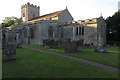
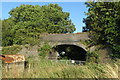
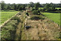
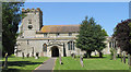
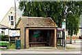
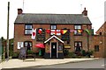
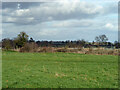
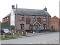
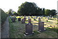
Photos of MK18 4ZP


Area Information
MK18 4ZP is a small, residential postcode area in England with a population of 2,469 people spread across 80 individuals per square kilometre. It is a compact cluster of homes, ideal for those seeking a quiet, low-density living environment. The area’s demographic profile suggests a mature community, with a median age of 47 and a strong presence of adults aged 30–64. Daily life here is characterised by a balance between residential tranquillity and practical access to nearby amenities. The area benefits from a low crime risk, with a safety score of 75, and no significant environmental hazards such as flood zones or protected natural sites. Residents have easy access to local schools, retail outlets, and rail connections, making it a convenient base for families or professionals. The lack of major planning constraints means the area is free from restrictions that could complicate property development or ownership. For those prioritising safety, stability, and a manageable pace of life, MK18 4ZP offers a straightforward, uncluttered alternative to more densely populated regions.
- Area Type
- Postcode
- Area Size
- Not available
- Population
- 2469
- Population Density
- 80 people/km²
The property market in MK18 4ZP is dominated by owner-occupied homes, with 78% of residents living in properties they own. This suggests a stable market with little reliance on rental demand, which is uncommon in smaller postcode areas. The accommodation type is primarily houses, which are typically larger and more private than flats. This housing stock may appeal to families or individuals prioritising space and privacy. Given the area’s small size, the property market is likely limited to a handful of listings, requiring buyers to consider nearby postcode areas for broader options. The absence of planning constraints or environmental restrictions means properties are not subject to additional costs or limitations. For those seeking a straightforward, low-risk purchase with a focus on long-term ownership, MK18 4ZP offers a pragmatic choice.
House Prices in MK18 4ZP
No properties found in this postcode.
Energy Efficiency in MK18 4ZP
Living in MK18 4ZP offers access to a range of local amenities within practical reach. The area includes five retail outlets, such as Co-op Steeple, Co-op EGMF, and Aldi Buckingham, providing everyday shopping needs. Nearby rail stations, Bicester North and Bicester Village, connect residents to broader networks for travel or commuting. While the area lacks large-scale leisure facilities, the presence of shops and transport links ensures a convenient lifestyle. The small cluster of homes fosters a close-knit community feel, with amenities tailored to daily necessities rather than extravagant leisure options. For residents prioritising accessibility and simplicity, MK18 4ZP delivers a straightforward, functional living environment.
Amenities
Schools
The nearest school to MK18 4ZP is Twyford C of E School, a primary school with a good Ofsted rating. This provides families with access to a well-regarded early education option for children aged 4–11. The absence of secondary schools in the immediate area means parents may need to look further afield for secondary education, but the primary school’s quality offers a solid foundation. The school’s rating suggests a focus on academic standards and pastoral care, which is crucial for young families. The single school type in the area highlights a need for additional educational facilities, but the existing option is a reliable resource for local residents. For those prioritising school quality, Twyford C of E School is a key consideration.
| Rank | School | Type | Entry gender | Ages |
|---|
Explore more schools in this area
Go to Schools tabDemographics
The community in MK18 4ZP is predominantly composed of adults aged 30–64, with a median age of 47. This suggests a mature population, likely with established careers and families. Home ownership is high, with 78% of residents owning their homes, indicating a stable and long-term demographic. The accommodation type is primarily houses, which aligns with the area’s low population density. The predominant ethnic group is White, reflecting a homogenous community profile. There is no specific data on deprivation levels, but the high home ownership and low crime risk suggest a generally secure and self-sufficient population. The absence of significant diversity metrics means the area’s social fabric is largely defined by its core demographic. For buyers, this profile may appeal to those seeking a settled, low-maintenance environment with minimal turnover of residents.
Household Size
Accommodation Type
Tenure
Ethnic Group
Religion
Household Composition
Age
Household Deprivation
NS-SEC
Explore more demographic insights in this area
Go to Demographics tabPlanning
Planning Constraints
- Flood RiskPremium
- Ramsar Wetland SitesPremium
- Area of Outstanding Natural BeautyPremium
- Protected Nature ReservePremium
- Protected WoodlandPremium