Area Overview for MK18 4AD
Photos of MK18 4AD


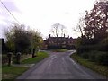
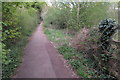
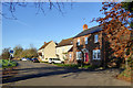
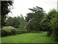


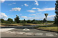
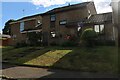
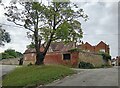
22 photos from this area
Area Information
Key information about the MK18 4AD including its size, population, and administrative classification.
- Area Type
- Postcode
- Area Size
- 2.7 hectares
- Population
- 1299
- Population Density
- 37 people/km²
House Prices in MK18 4AD
16
Properties
£497,493
Average Sold Price
£344,950
Lowest Price
£742,500
Highest Price
Showing 16 properties
| Address | Type | Beds | Baths | Last Sale Price | Last Sale Date | |
|---|---|---|---|---|---|---|
| Ledbury House, Stable Close, Finmere, MK18 4AD | Detached | 5 | - | £742,500 | Feb 2021 | |
| The Warren, 10 Stable Close, Finmere, MK18 4AD | house | - | - | £540,000 | May 2020 | |
| 14 Stable Close, Finmere, MK18 4AD | Detached | 5 | 1 | £605,000 | Jun 2018 | |
| 1 Stable Close, Finmere, MK18 4AD | Detached | 5 | 2 | £592,500 | Jul 2017 | |
| 16 Stable Close, Finmere, MK18 4AD | Detached | 5 | - | £570,000 | May 2017 | |
| 4 Stable Close, Finmere, MK18 4AD | Detached | 5 | 2 | £450,000 | Jul 2015 | |
| Dovecote Barn, Stable Close, Finmere, MK18 4AD | Semi-detached | 4 | 2 | £452,000 | Dec 2014 | |
| 3 Stable Close, Finmere, MK18 4AD | Detached | 5 | - | £470,000 | May 2013 | |
| 5 Stable Close, Finmere, MK18 4AD | Detached | 5 | - | £400,000 | Dec 2011 | |
| 7 Stable Close, Finmere, MK18 4AD | Detached | 5 | - | £499,950 | Sep 2007 |
Page 1 of 2
Energy Efficiency in MK18 4AD
Amenities
Schools
| Rank | School | Type | Entry gender | Ages |
|---|
Explore more schools in this area
Go to Schools tabDemographics
Household Size
Two person
most common
Accommodation Type
Houses
most common
Tenure
76
majority
Ethnic Group
White
most common
Religion
N/A
most common
Household Composition
N/A
most common
Age
47
median
Adults (30-64 years)
most common
Household Deprivation
N/A
with no deprivation
NS-SEC
47
in Lower managerial occupations
Explore more demographic insights in this area
Go to Demographics tabPlanning
Planning Constraints
- Flood RiskPremium
- Ramsar Wetland SitesPremium
- Area of Outstanding Natural BeautyPremium
- Protected Nature ReservePremium
- Protected WoodlandPremium