Area Overview for MK18 3XZ
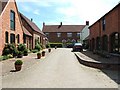
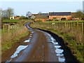
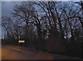
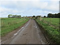
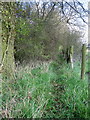
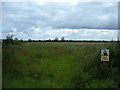
Photos of MK18 3XZ
Area Information
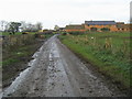
MK18 3XZ is a small, tightly knit residential cluster in England, home to 1,870 people spread across 16 km². With a population density of 116 people per km², it’s a quiet, low-rise area where daily life revolves around local amenities and community ties. The area’s character is defined by its mature population, with a median age of 47 and most residents falling within the 30-64 age range. This suggests a stable, family-oriented community where many have lived for years. The presence of a single primary school and nearby retail outlets indicates a self-contained lifestyle, though residents are within reach of broader services via the Leighton Buzzard railway station. The area’s low crime risk and absence of environmental constraints make it appealing for those seeking a peaceful, secure place to live. While it lacks the vibrancy of larger towns, MK18 3XZ offers a simple, predictable rhythm of life, ideal for those prioritising safety and quiet over urban convenience.
- Area Type
- Postcode
- Area Size
- Not available
- Population
- 1870
- Population Density
- 116 people/km²
MK18 3XZ is a predominantly owner-occupied area, with 79% of properties owned by residents rather than rented. The accommodation type is primarily houses, indicating a focus on family homes and single-unit properties. This suggests a market tailored to those seeking long-term stability rather than short-term rental opportunities. The small size of the area means the housing stock is limited, but the high home ownership rate implies a strong sense of community among residents. For buyers, this translates to a niche market where properties are likely to be in good condition and well-maintained. The lack of flats or high-density housing means the area is not ideal for those seeking urban living or investment in rental properties. Proximity to Leighton Buzzard railway station may appeal to commuters, but the area’s character is defined by its quiet, residential nature rather than commercial development.
House Prices in MK18 3XZ
No properties found in this postcode.
Energy Efficiency in MK18 3XZ
MK18 3XZ offers a modest selection of amenities within practical reach, including five retail outlets such as Co-op Winslow, Tesco Linslade, and Asda Newton. These stores provide everyday shopping needs, from groceries to household essentials, reducing the need for long trips to larger centres. The Leighton Buzzard railway station adds accessibility to broader services, though the area lacks dedicated leisure or recreational spaces like parks or gyms. The retail options suggest a focus on convenience over luxury, making daily life manageable for residents. While the data does not mention dining or entertainment venues, the presence of multiple supermarkets indicates a functional, no-frills lifestyle. For those prioritising self-sufficiency and proximity to essential services, MK18 3XZ delivers practicality over variety.
Amenities
Schools
The nearest school to MK18 3XZ is St Michael’s Church of England Combined School, a primary school with an Ofsted rating of ‘good’. This provides a solid foundation for local children, though no secondary schools are listed in the data. The presence of a primary school within the area supports families seeking convenience, reducing the need for long commutes to education. The ‘good’ Ofsted rating indicates that the school meets national standards in teaching and student outcomes, though it does not provide specific details on subjects offered or extracurricular activities. For parents prioritising proximity to schools, this is a key advantage of MK18 3XZ. However, those requiring secondary education may need to look further afield, as the data does not mention nearby secondary schools.
| Rank | School | Type | Entry gender | Ages |
|---|
Explore more schools in this area
Go to Schools tabDemographics
The population of MK18 3XZ is predominantly middle-aged and older, with a median age of 47 and 79% of residents owning their homes. This high home ownership rate suggests a long-term, stable community where many have lived for decades. The most common age group, 30-64 years, indicates a mix of working-age adults and retirees, likely contributing to a balanced social dynamic. Accommodation is primarily houses, reflecting a preference for family-sized properties over flats. The predominant ethnic group is White, though no specific diversity statistics are provided. With 79% home ownership, the area is less reliant on rental markets, which may influence local property values and community cohesion. The absence of detailed deprivation data means it’s unclear how economic disparities might affect quality of life, but the low crime risk and lack of environmental constraints suggest a generally stable environment.
Household Size
Accommodation Type
Tenure
Ethnic Group
Religion
Household Composition
Age
Household Deprivation
NS-SEC
Explore more demographic insights in this area
Go to Demographics tabPlanning
Planning Constraints
- Flood RiskPremium
- Ramsar Wetland SitesPremium
- Area of Outstanding Natural BeautyPremium
- Protected Nature ReservePremium
- Protected WoodlandPremium