Area Overview for MK18 3NT
Photos of MK18 3NT
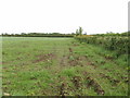
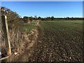
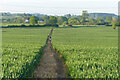
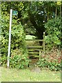
8 photos from this area
Area Information
Key information about the MK18 3NT including its size, population, and administrative classification.
- Area Type
- Postcode
- Area Size
- 86.8 hectares
- Population
- 1206
- Population Density
- 43 people/km²
House Prices in MK18 3NT
61
Properties
£417,389
Average Sold Price
£84,000
Lowest Price
£800,000
Highest Price
Showing 61 properties
| Address | Type | Beds | Baths | Last Sale Price | Last Sale Date | |
|---|---|---|---|---|---|---|
| Barnview, 20F Green End, Granborough, MK18 3NT | Semi-detached | 3 | 2 | £490,000 | Jan 2025 | |
| 14 Green End, Granborough, MK18 3NT | house | - | - | £300,000 | Oct 2024 | |
| Pye Corner, Green End, Granborough, MK18 3NT | house | - | - | £497,500 | Jun 2021 | |
| Juniper Barn, Green End, Granborough, MK18 3NT | house | - | - | £565,000 | Apr 2021 | |
| 25A Green End, Granborough, MK18 3NT | house | - | - | £550,000 | Jan 2021 | |
| 19 Green End, Granborough, MK18 3NT | Detached | 5 | 3 | £570,000 | Aug 2019 | |
| Chester House, 6 Green End, Granborough, MK18 3NT | house | - | - | £800,000 | Jun 2019 | |
| 15 Green End, Granborough, MK18 3NT | house | 4 | 2 | £472,500 | May 2019 | |
| 31 Green End, Granborough, MK18 3NT | Detached | 3 | 2 | £460,000 | Jul 2018 | |
| 30 Green End, Granborough, MK18 3NT | Bungalow | - | - | £550,000 | Jul 2017 |
Page 1 of 7
Energy Efficiency in MK18 3NT
Amenities
Schools
| Rank | School | Type | Entry gender | Ages |
|---|
Explore more schools in this area
Go to Schools tabDemographics
Household Size
Two person
most common
Accommodation Type
Houses
most common
Tenure
69
majority
Ethnic Group
White
most common
Religion
N/A
most common
Household Composition
N/A
most common
Age
47
median
Adults (30-64 years)
most common
Household Deprivation
N/A
with no deprivation
NS-SEC
44
in Lower managerial occupations
Explore more demographic insights in this area
Go to Demographics tabPlanning
Planning Constraints
- Flood RiskPremium
- Ramsar Wetland SitesPremium
- Area of Outstanding Natural BeautyPremium
- Protected Nature ReservePremium
- Protected WoodlandPremium