Area Overview for MK18 3NL
Photos of MK18 3NL
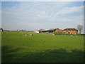
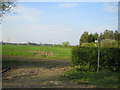
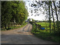
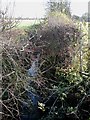
14 photos from this area
Area Information
Key information about the MK18 3NL including its size, population, and administrative classification.
- Area Type
- Postcode
- Area Size
- 1.8 km²
- Population
- 1206
- Population Density
- 43 people/km²
House Prices in MK18 3NL
12
Properties
£497,400
Average Sold Price
£117,000
Lowest Price
£755,000
Highest Price
Showing 12 properties
| Address | Type | Beds | Baths | Last Sale Price | Last Sale Date | |
|---|---|---|---|---|---|---|
| 2B Hogshaw Road, Granborough, MK18 3NL | house | - | - | £500,000 | Jul 2022 | |
| 6 Hogshaw Road, Granborough, MK18 3NL | Detached | 3 | - | £670,000 | Sep 2013 | |
| Bracknall House, Hogshaw Road, Granborough, MK18 3NL | Detached | 4 | - | £755,000 | Nov 2012 | |
| Hollow Hill, Hogshaw Road, Granborough, MK18 3NL | Detached | - | - | £445,000 | Dec 2005 | |
| 2A Hogshaw Road, Granborough, MK18 3NL | Detached | - | - | £117,000 | Aug 1998 | |
| 2 Hogshaw Road, Granborough, MK18 3NL | Land | - | - | - | - | |
| Mobile Home, Staplers Piece, Hogshaw Road, Granborough, MK18 3NL | undefined | - | - | - | - | |
| New Dwelling, Hogshaw Road, Granborough, MK18 3NL | undefined | - | - | - | - | |
| Staplers Piece, Hogshaw Road, Granborough, MK18 3NL | Detached | - | - | - | - | |
| Hogshaw Road Farm, Hogshaw Road, Granborough, MK18 3NL | house | - | - | - | - |
Page 1 of 2
Energy Efficiency in MK18 3NL
Amenities
Schools
| Rank | School | Type | Entry gender | Ages |
|---|
Explore more schools in this area
Go to Schools tabDemographics
Household Size
Two person
most common
Accommodation Type
Houses
most common
Tenure
69
majority
Ethnic Group
White
most common
Religion
N/A
most common
Household Composition
N/A
most common
Age
47
median
Adults (30-64 years)
most common
Household Deprivation
N/A
with no deprivation
NS-SEC
44
in Lower managerial occupations
Explore more demographic insights in this area
Go to Demographics tabPlanning
Planning Constraints
- Flood RiskPremium
- Ramsar Wetland SitesPremium
- Area of Outstanding Natural BeautyPremium
- Protected Nature ReservePremium
- Protected WoodlandPremium