Area Overview for MK18 2DZ
Photos of MK18 2DZ
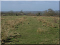
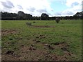
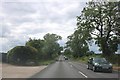
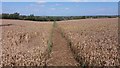
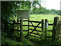
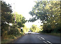
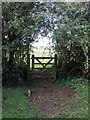
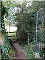

14 photos from this area
Area Information
Key information about the MK18 2DZ including its size, population, and administrative classification.
- Area Type
- Postcode
- Area Size
- 87.2 hectares
- Population
- 1609
- Population Density
- 64 people/km²
House Prices in MK18 2DZ
9
Properties
£513,750
Average Sold Price
£310,000
Lowest Price
£825,000
Highest Price
Showing 9 properties
| Address | Type | Beds | Baths | Last Sale Price | Last Sale Date | |
|---|---|---|---|---|---|---|
| The Folly, Bletchley Road, Thornborough, MK18 2DZ | Detached | 5 | - | £525,000 | Sep 2010 | |
| Old Priory Farm, Bletchley Road, Thornborough, MK18 2DZ | house | - | - | £825,000 | Jun 2005 | |
| Fieldview Farm, Bletchley Road, Thornborough, MK18 2DZ | Detached | - | - | £395,000 | Apr 2004 | |
| Maywynn Farm, Bletchley Road, Thornborough, MK18 2DZ | Detached | 4 | - | £310,000 | Jan 2000 | |
| Windy Ridge, Bletchley Road, Thornborough, MK18 2DZ | Bungalow | 4 | - | - | - | |
| Priory Farm, Bletchley Road, Thornborough, MK18 2DZ | Detached | 5 | 3 | - | - | |
| Barrs Nursery, Bletchley Road, Thornborough, MK18 2DZ | commercial | - | - | - | - | |
| Annexe, Windy Ridge, Bletchley Road, Thornborough, MK18 2DZ | house | - | - | - | - | |
| Barrs Nurseries, Bletchley Road, Thornborough, MK18 2DZ | shop | - | - | - | - |
Energy Efficiency in MK18 2DZ
Amenities
Schools
| Rank | School | Type | Entry gender | Ages |
|---|
Explore more schools in this area
Go to Schools tabDemographics
Household Size
Family (3-5 people)
most common
Accommodation Type
Houses
most common
Tenure
85
majority
Ethnic Group
White
most common
Religion
N/A
most common
Household Composition
N/A
most common
Age
47
median
Adults (30-64 years)
most common
Household Deprivation
N/A
with no deprivation
NS-SEC
49
in Lower managerial occupations
Explore more demographic insights in this area
Go to Demographics tabPlanning
Planning Constraints
- Flood RiskPremium
- Ramsar Wetland SitesPremium
- Area of Outstanding Natural BeautyPremium
- Protected Nature ReservePremium
- Protected WoodlandPremium