Area Overview for MK18 2BB
Photos of MK18 2BB
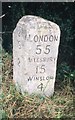
7 photos from this area
Area Information
Key information about the MK18 2BB including its size, population, and administrative classification.
- Area Type
- Postcode
- Area Size
- 57.3 hectares
- Population
- 1403
- Population Density
- 77 people/km²
House Prices in MK18 2BB
20
Properties
£568,636
Average Sold Price
£210,000
Lowest Price
£1,115,000
Highest Price
Showing 20 properties
| Address | Type | Beds | Baths | Last Sale Price | Last Sale Date | |
|---|---|---|---|---|---|---|
| Old End Barn, Old End, Padbury, MK18 2BB | Detached | 2 | 1 | £425,000 | Nov 2025 | |
| Meadow House, Old End, Padbury, MK18 2BB | Detached | - | - | £800,000 | Jul 2025 | |
| 20 Old End, Padbury, MK18 2BB | house | 3 | 1 | £350,000 | Aug 2022 | |
| 14 Old End, Padbury, MK18 2BB | Land | 4 | 3 | £305,000 | Apr 2021 | |
| Sunny Hill Farm, Old End, Padbury, MK18 2BB | Detached | 4 | 1 | £1,115,000 | Apr 2019 | |
| Tudor Cottage, Old End, Padbury, MK18 2BB | house | - | - | £440,000 | Jan 2019 | |
| Carlina Cottage, Old End, Padbury, MK18 2BB | Cottage | 3 | 3 | £625,000 | Dec 2018 | |
| Jessamine Cottage, Old End, Padbury, MK18 2BB | Semi-detached | - | - | £210,000 | Nov 2018 | |
| Old Farm House, Old End, Padbury, MK18 2BB | Detached | - | - | £950,000 | Oct 2010 | |
| 16 Old End, Padbury, MK18 2BB | house | - | - | £550,000 | Jul 2009 |
Page 1 of 2
Energy Efficiency in MK18 2BB
Amenities
Schools
| Rank | School | Type | Entry gender | Ages |
|---|
Explore more schools in this area
Go to Schools tabDemographics
Household Size
Two person
most common
Accommodation Type
Houses
most common
Tenure
75
majority
Ethnic Group
White
most common
Religion
N/A
most common
Household Composition
N/A
most common
Age
47
median
Adults (30-64 years)
most common
Household Deprivation
N/A
with no deprivation
NS-SEC
46
in Lower managerial occupations
Explore more demographic insights in this area
Go to Demographics tabPlanning
Planning Constraints
- Flood RiskPremium
- Ramsar Wetland SitesPremium
- Area of Outstanding Natural BeautyPremium
- Protected Nature ReservePremium
- Protected WoodlandPremium