Area Overview for MK18 1ZJ
Photos of MK18 1ZJ


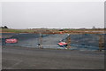


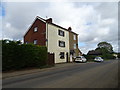


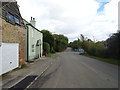

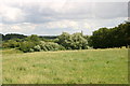
20 photos from this area
Area Information
Key information about the MK18 1ZJ including its size, population, and administrative classification.
- Area Type
- Postcode
- Area Size
- 1.5 hectares
- Population
- 2504
- Population Density
- 1391 people/km²
House Prices in MK18 1ZJ
54
Properties
£407,875
Average Sold Price
£265,000
Lowest Price
£558,995
Highest Price
Showing 54 properties
| Address | Type | Beds | Baths | Last Sale Price | Last Sale Date | |
|---|---|---|---|---|---|---|
| 24 Swithin Lane, Buckingham, MK18 1ZJ | house | - | - | £405,000 | Sep 2025 | |
| 35 Swithin Lane, Buckingham, MK18 1ZJ | Detached | 4 | 2 | £515,000 | Aug 2025 | |
| 3 Swithin Lane, Buckingham, MK18 1ZJ | Retail | 3 | 2 | £383,000 | Mar 2025 | |
| 16 Swithin Lane, Buckingham, MK18 1ZJ | Semi-detached | 3 | 3 | £400,000 | Oct 2024 | |
| 53 Swithin Lane, Buckingham, MK18 1ZJ | Maisonette | 2 | 1 | £265,000 | Jan 2024 | |
| 43 Swithin Lane, Buckingham, MK18 1ZJ | house | - | - | £460,000 | May 2023 | |
| 47 Swithin Lane, Buckingham, MK18 1ZJ | Semi-detached | 2 | 1 | £377,500 | Apr 2023 | |
| 51 Swithin Lane, Buckingham, MK18 1ZJ | house | - | - | £352,500 | Jan 2023 | |
| 49 Swithin Lane, Buckingham, MK18 1ZJ | house | - | - | £386,000 | Jan 2023 | |
| 45 Swithin Lane, Buckingham, MK18 1ZJ | Flat | 2 | 1 | £350,000 | Dec 2022 |
Page 1 of 6
Energy Efficiency in MK18 1ZJ
Amenities
Schools
| Rank | School | Type | Entry gender | Ages |
|---|---|---|---|---|
| 1 | Grenville Combined School | primary | N/A | N/A |
| 2 | Buckingham School | primary | N/A | N/A |
| 3 | Royal Latin School | primary | N/A | N/A |
| 4 | Chandos County Middle School | primary | N/A | N/A |
| 5 | Royal Latin School | academy | N/A | N/A |
Explore more schools in this area
Go to Schools tabDemographics
Household Size
Two person
most common
Accommodation Type
Houses
most common
Tenure
66
majority
Ethnic Group
White
most common
Religion
N/A
most common
Household Composition
N/A
most common
Age
47
median
Adults (30-64 years)
most common
Household Deprivation
N/A
with no deprivation
NS-SEC
39
in Lower managerial occupations
Explore more demographic insights in this area
Go to Demographics tabPlanning
Planning Constraints
- Flood RiskPremium
- Ramsar Wetland SitesPremium
- Area of Outstanding Natural BeautyPremium
- Protected Nature ReservePremium
- Protected WoodlandPremium
- Crime RiskPremium