Area Overview for MK18 1XB
Photos of MK18 1XB

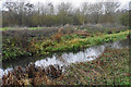
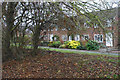
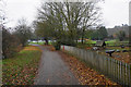
36 photos from this area
Area Information
Key information about the MK18 1XB including its size, population, and administrative classification.
- Area Type
- Postcode
- Area Size
- 6591 m²
- Population
- 1535
- Population Density
- 3031 people/km²
House Prices in MK18 1XB
13
Properties
£181,722
Average Sold Price
£45,000
Lowest Price
£332,500
Highest Price
Showing 13 properties
| Address | Type | Beds | Baths | Last Sale Price | Last Sale Date | |
|---|---|---|---|---|---|---|
| 9 Bartlett Place, Buckingham, MK18 1XB | Detached | 3 | 1 | £332,500 | Jun 2018 | |
| 7 Bartlett Place, Buckingham, MK18 1XB | Detached | 3 | 1 | £240,000 | Dec 2013 | |
| 11 Bartlett Place, Buckingham, MK18 1XB | Detached | 4 | - | £295,000 | May 2013 | |
| 15 Bartlett Place, Buckingham, MK18 1XB | Detached | 3 | 2 | £218,000 | Dec 2012 | |
| 13 Bartlett Place, Buckingham, MK18 1XB | Detached | - | - | £164,500 | Mar 2003 | |
| 1 Bartlett Place, Buckingham, MK18 1XB | house | - | - | £147,500 | Jun 2001 | |
| 8 Bartlett Place, Buckingham, MK18 1XB | house | - | - | £45,000 | Jun 1997 | |
| 3 Bartlett Place, Buckingham, MK18 1XB | Detached | - | - | £113,000 | Feb 1997 | |
| 10 Bartlett Place, Buckingham, MK18 1XB | house | - | - | £80,000 | Nov 1995 | |
| 5 Bartlett Place, Buckingham, MK18 1XB | Detached | 4 | 1 | - | - |
Page 1 of 2
Energy Efficiency in MK18 1XB
Amenities
Schools
| Rank | School | Type | Entry gender | Ages |
|---|
Explore more schools in this area
Go to Schools tabDemographics
Household Size
Two person
most common
Accommodation Type
Houses
most common
Tenure
93
majority
Ethnic Group
White
most common
Religion
N/A
most common
Household Composition
N/A
most common
Age
47
median
Adults (30-64 years)
most common
Household Deprivation
N/A
with no deprivation
NS-SEC
50
in Lower managerial occupations
Explore more demographic insights in this area
Go to Demographics tabPlanning
Planning Constraints
- Flood RiskPremium
- Ramsar Wetland SitesPremium
- Area of Outstanding Natural BeautyPremium
- Protected Nature ReservePremium
- Protected WoodlandPremium