Area Overview for MK17 9JT
Photos of MK17 9JT
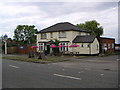
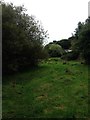
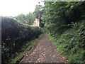
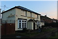

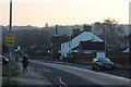
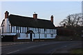

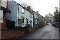
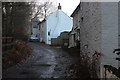
22 photos from this area
Area Information
Key information about the MK17 9JT including its size, population, and administrative classification.
- Area Type
- Postcode
- Area Size
- 5.5 hectares
- Population
- 1716
- Population Density
- 133 people/km²
House Prices in MK17 9JT
24
Properties
£458,479
Average Sold Price
£187,500
Lowest Price
£1,150,000
Highest Price
Showing 24 properties
| Address | Type | Beds | Baths | Last Sale Price | Last Sale Date | |
|---|---|---|---|---|---|---|
| 92 Station Road, Bow Brickhill, MK17 9JT | Terraced | 2 | 1 | £255,000 | May 2025 | |
| 74A Station Road, Bow Brickhill, MK17 9JT | house | - | - | £1,150,000 | Aug 2022 | |
| 66 Station Road, Bow Brickhill, MK17 9JT | house | - | - | £355,000 | Sep 2021 | |
| 88 Station Road, Bow Brickhill, MK17 9JT | Terraced | 2 | 1 | £245,000 | Sep 2020 | |
| 72 Station Road, Bow Brickhill, MK17 9JT | Cottage | 3 | 1 | £250,000 | Dec 2014 | |
| 74 Station Road, Bow Brickhill, MK17 9JT | Semi-detached | 2 | - | £224,750 | Apr 2014 | |
| Old Manor Farm House, Station Road, Bow Brickhill, MK17 9JT | Detached | 6 | 6 | £915,000 | May 2013 | |
| 78 Station Road, Bow Brickhill, MK17 9JT | house | 4 | - | £450,000 | Oct 2011 | |
| The Old Hayloft, 78A Station Road, Bow Brickhill, MK17 9JT | Semi-detached | 4 | - | £677,000 | Dec 2010 | |
| 98 Station Road, Bow Brickhill, MK17 9JT | house | - | - | £312,500 | Sep 2005 |
Page 1 of 3
Energy Efficiency in MK17 9JT
Amenities
Schools
| Rank | School | Type | Entry gender | Ages |
|---|
Explore more schools in this area
Go to Schools tabDemographics
Household Size
Two person
most common
Accommodation Type
Houses
most common
Tenure
73
majority
Ethnic Group
White
most common
Religion
N/A
most common
Household Composition
N/A
most common
Age
47
median
Adults (30-64 years)
most common
Household Deprivation
N/A
with no deprivation
NS-SEC
46
in Lower managerial occupations
Explore more demographic insights in this area
Go to Demographics tabPlanning
Planning Constraints
- Flood RiskPremium
- Ramsar Wetland SitesPremium
- Area of Outstanding Natural BeautyPremium
- Protected Nature ReservePremium
- Protected WoodlandPremium