Area Overview for MK17 9BS
Photos of MK17 9BS
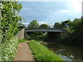
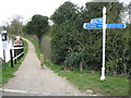
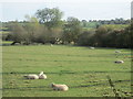
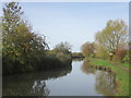
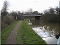
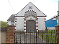
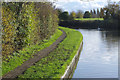
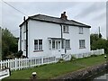
35 photos from this area
Area Information
Key information about the MK17 9BS including its size, population, and administrative classification.
- Area Type
- Postcode
- Area Size
- 5.2 hectares
- Population
- 2568
- Population Density
- 130 people/km²
House Prices in MK17 9BS
25
Properties
£269,795
Average Sold Price
£92,000
Lowest Price
£530,000
Highest Price
Showing 25 properties
| Address | Type | Beds | Baths | Last Sale Price | Last Sale Date | |
|---|---|---|---|---|---|---|
| 22 Tyrells Road, Stoke Hammond, MK17 9BS | Semi-detached | 4 | 2 | £530,000 | Apr 2025 | |
| 10 Tyrells Road, Stoke Hammond, MK17 9BS | Semi-detached | 2 | 1 | £322,000 | Sep 2022 | |
| 21 Tyrells Road, Stoke Hammond, MK17 9BS | Semi-detached | 4 | 1 | £470,000 | Feb 2021 | |
| 7 Tyrells Road, Stoke Hammond, MK17 9BS | house | - | - | £225,000 | Oct 2017 | |
| 1 Tyrells Road, Stoke Hammond, MK17 9BS | Semi-detached | 4 | 1 | £370,000 | Dec 2016 | |
| 14 Tyrells Road, Stoke Hammond, MK17 9BS | Semi-detached | - | - | £155,000 | Oct 2013 | |
| 19 Tyrells Road, Stoke Hammond, MK17 9BS | Semi-detached | - | - | £210,000 | Aug 2009 | |
| 13 Tyrells Road, Stoke Hammond, MK17 9BS | Semi-detached | - | - | £217,500 | Jul 2007 | |
| 8 Tyrells Road, Stoke Hammond, MK17 9BS | Semi-detached | - | - | £216,250 | Sep 2006 | |
| 6 Tyrells Road, Stoke Hammond, MK17 9BS | house | - | - | £160,000 | Sep 2003 |
Page 1 of 3
Energy Efficiency in MK17 9BS
Amenities
Schools
| Rank | School | Type | Entry gender | Ages |
|---|
Explore more schools in this area
Go to Schools tabDemographics
Household Size
Family (3-5 people)
most common
Accommodation Type
Houses
most common
Tenure
74
majority
Ethnic Group
White
most common
Religion
N/A
most common
Household Composition
N/A
most common
Age
47
median
Adults (30-64 years)
most common
Household Deprivation
N/A
with no deprivation
NS-SEC
46
in Lower managerial occupations
Explore more demographic insights in this area
Go to Demographics tabPlanning
Planning Constraints
- Flood RiskPremium
- Ramsar Wetland SitesPremium
- Area of Outstanding Natural BeautyPremium
- Protected Nature ReservePremium
- Protected WoodlandPremium