Area Overview for MK17 8PR
Photos of MK17 8PR
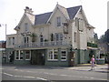
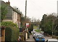

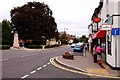


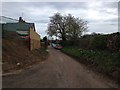

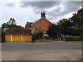

27 photos from this area
Area Information
Key information about the MK17 8PR including its size, population, and administrative classification.
- Area Type
- Postcode
- Area Size
- 4025 m²
- Population
- 2251
- Population Density
- 2173 people/km²
House Prices in MK17 8PR
8
Properties
£487,083
Average Sold Price
£240,000
Lowest Price
£760,000
Highest Price
Showing 8 properties
| Address | Type | Beds | Baths | Last Sale Price | Last Sale Date | |
|---|---|---|---|---|---|---|
| Theydon Lodge, Theydon Avenue, Woburn Sands, MK17 8PR | house | - | - | £760,000 | Feb 2025 | |
| 42 Theydon Avenue, Woburn Sands, MK17 8PR | house | - | - | £522,500 | Jun 2022 | |
| 38 Theydon Avenue, Woburn Sands, MK17 8PR | Semi-detached | 4 | 2 | £485,000 | Jan 2017 | |
| 52 Theydon Avenue, Woburn Sands, MK17 8PR | Bungalow | 3 | 1 | £390,000 | Dec 2015 | |
| 40 Theydon Avenue, Woburn Sands, MK17 8PR | Semi-detached | 4 | 3 | £240,000 | Oct 2013 | |
| 46 Theydon Avenue, Woburn Sands, MK17 8PR | Detached | 4 | 3 | £525,000 | Apr 2008 | |
| 48 Theydon Avenue, Woburn Sands, MK17 8PR | Detached | - | - | - | - | |
| 50 Theydon Avenue, Woburn Sands, MK17 8PR | Bungalow | 2 | 1 | - | - |
Energy Efficiency in MK17 8PR
Amenities
Schools
| Rank | School | Type | Entry gender | Ages |
|---|
Explore more schools in this area
Go to Schools tabDemographics
Household Size
Family (3-5 people)
most common
Accommodation Type
Houses
most common
Tenure
69
majority
Ethnic Group
White
most common
Religion
N/A
most common
Household Composition
N/A
most common
Age
47
median
Adults (30-64 years)
most common
Household Deprivation
N/A
with no deprivation
NS-SEC
46
in Lower managerial occupations
Explore more demographic insights in this area
Go to Demographics tabPlanning
Planning Constraints
- Flood RiskPremium
- Ramsar Wetland SitesPremium
- Area of Outstanding Natural BeautyPremium
- Protected Nature ReservePremium
- Protected WoodlandPremium