Area Overview for MK17 8NQ
Photos of MK17 8NQ
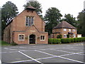
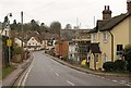
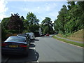
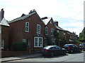
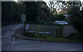
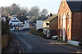
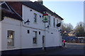
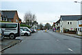
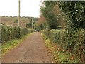
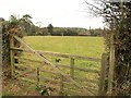
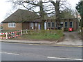
17 photos from this area
Area Information
Key information about the MK17 8NQ including its size, population, and administrative classification.
- Area Type
- Postcode
- Area Size
- 8767 m²
- Population
- 1422
- Population Density
- 3739 people/km²
House Prices in MK17 8NQ
19
Properties
£376,179
Average Sold Price
£135,000
Lowest Price
£530,000
Highest Price
Showing 19 properties
| Address | Type | Beds | Baths | Last Sale Price | Last Sale Date | |
|---|---|---|---|---|---|---|
| 16 Downham Road, Woburn Sands, MK17 8NQ | Semi-detached | 4 | 3 | £500,000 | Oct 2025 | |
| 40 Downham Road, Woburn Sands, MK17 8NQ | Detached | 3 | 1 | £510,000 | Aug 2025 | |
| 22 Downham Road, Woburn Sands, MK17 8NQ | house | - | - | £422,000 | Nov 2018 | |
| 50 Downham Road, Woburn Sands, MK17 8NQ | Semi-detached | 4 | 2 | £372,000 | Jun 2018 | |
| 6 Downham Road, Woburn Sands, MK17 8NQ | house | 4 | 2 | £285,000 | Jul 2014 | |
| 4 Downham Road, Woburn Sands, MK17 8NQ | Detached | 4 | - | £530,000 | Mar 2014 | |
| 10 Downham Road, Woburn Sands, MK17 8NQ | house | - | - | £420,000 | Mar 2014 | |
| 24 Downham Road, Woburn Sands, MK17 8NQ | Bungalow | 3 | - | £460,000 | Jan 2014 | |
| 44 Downham Road, Woburn Sands, MK17 8NQ | house | - | - | £249,500 | Sep 2012 | |
| 42 Downham Road, Woburn Sands, MK17 8NQ | Bungalow | - | - | £425,000 | Nov 2011 |
Page 1 of 2
Energy Efficiency in MK17 8NQ
Amenities
Schools
| Rank | School | Type | Entry gender | Ages |
|---|
Explore more schools in this area
Go to Schools tabDemographics
Household Size
Two person
most common
Accommodation Type
Houses
most common
Tenure
75
majority
Ethnic Group
White
most common
Religion
N/A
most common
Household Composition
N/A
most common
Age
47
median
Adults (30-64 years)
most common
Household Deprivation
N/A
with no deprivation
NS-SEC
42
in Lower managerial occupations
Explore more demographic insights in this area
Go to Demographics tabPlanning
Planning Constraints
- Flood RiskPremium
- Ramsar Wetland SitesPremium
- Area of Outstanding Natural BeautyPremium
- Protected Nature ReservePremium
- Protected WoodlandPremium