Area Overview for MK17 0PA
Photos of MK17 0PA
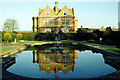
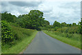
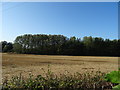
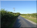
13 photos from this area
Area Information
Key information about the MK17 0PA including its size, population, and administrative classification.
- Area Type
- Postcode
- Area Size
- 3.6 hectares
- Population
- 1583
- Population Density
- 75 people/km²
House Prices in MK17 0PA
12
Properties
£412,083
Average Sold Price
£175,000
Lowest Price
£580,000
Highest Price
Showing 12 properties
| Address | Type | Beds | Baths | Last Sale Price | Last Sale Date | |
|---|---|---|---|---|---|---|
| The Clays, 4 Mursley Road, Little Horwood, MK17 0PA | house | - | - | £580,000 | Apr 2021 | |
| 9A Mursley Road, Little Horwood, MK17 0PA | house | - | - | £547,500 | Mar 2017 | |
| Ivy Cottage, 7 Mursley Road, Little Horwood, MK17 0PA | Detached | 4 | - | £510,000 | Oct 2013 | |
| Lavender Cottage, 8 Mursley Road, Little Horwood, MK17 0PA | Detached | - | - | £410,000 | Apr 2004 | |
| 6 Mursley Road, Swanbourne, MK17 0PA | Flat | - | - | £250,000 | Apr 2000 | |
| Rushbrook House, 5A Mursley Road, Little Horwood, MK17 0PA | Detached | - | - | £175,000 | Jun 1995 | |
| Roseberry, 1 Mursley Road, Little Horwood, MK17 0PA | Detached | 4 | - | - | - | |
| 9-11 Mursley Road, Little Horwood, MK17 0PA | house | 4 | - | - | - | |
| Flat At, 9-11 Mursley Road, Little Horwood, MK17 0PA | Flat | - | - | - | - | |
| Watercroft, 2 Mursley Road, Little Horwood, MK17 0PA | house | - | - | - | - |
Page 1 of 2
Energy Efficiency in MK17 0PA
Amenities
Schools
| Rank | School | Type | Entry gender | Ages |
|---|
Explore more schools in this area
Go to Schools tabDemographics
Household Size
Two person
most common
Accommodation Type
Houses
most common
Tenure
83
majority
Ethnic Group
White
most common
Religion
N/A
most common
Household Composition
N/A
most common
Age
47
median
Adults (30-64 years)
most common
Household Deprivation
N/A
with no deprivation
NS-SEC
46
in Lower managerial occupations
Explore more demographic insights in this area
Go to Demographics tabPlanning
Planning Constraints
- Flood RiskPremium
- Ramsar Wetland SitesPremium
- Area of Outstanding Natural BeautyPremium
- Protected Nature ReservePremium
- Protected WoodlandPremium