Area Overview for MK17 0JD
Photos of MK17 0JD
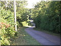
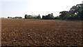
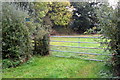
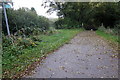
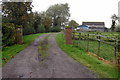
7 photos from this area
Area Information
Key information about the MK17 0JD including its size, population, and administrative classification.
- Area Type
- Postcode
- Area Size
- 1.5 km²
- Population
- 1385
- Population Density
- 88 people/km²
House Prices in MK17 0JD
16
Properties
£703,688
Average Sold Price
£331,500
Lowest Price
£1,100,000
Highest Price
Showing 16 properties
| Address | Type | Beds | Baths | Last Sale Price | Last Sale Date | |
|---|---|---|---|---|---|---|
| Richmond Hall, Stewkley Lane, Mursley, MK17 0JD | house | 5 | 3 | £815,000 | Feb 2019 | |
| Highcroft, Stewkley Lane, Mursley, MK17 0JD | Bungalow | 5 | 2 | £720,000 | Oct 2018 | |
| Ashdean Farm, Stewkley Lane, Mursley, MK17 0JD | Equestrian | 4 | 2 | £1,100,000 | Sep 2017 | |
| 6 Stewkley Lane, Mursley, MK17 0JD | house | - | - | £880,000 | Jul 2016 | |
| Hillbrough House, Stewkley Lane, Mursley, MK17 0JD | Detached | 4 | - | £825,000 | Sep 2014 | |
| Jay Cottage, 4 Stewkley Lane, Mursley, MK17 0JD | house | 3 | 1 | £343,000 | Apr 2012 | |
| Oak Tree Barn, Stewkley Lane, Mursley, MK17 0JD | Bungalow | - | - | £615,000 | Jun 2007 | |
| Nordens Farm, Stewkley Lane, Mursley, MK17 0JD | Detached | - | - | £331,500 | Jan 1999 | |
| 8 Stewkley Lane, Mursley, MK17 0JD | house | 4 | 3 | - | - | |
| Richmond House, Stewkley Lane, Mursley, MK17 0JD | house | 3 | - | - | - |
Page 1 of 2
Energy Efficiency in MK17 0JD
Amenities
Schools
| Rank | School | Type | Entry gender | Ages |
|---|
Explore more schools in this area
Go to Schools tabDemographics
Household Size
Two person
most common
Accommodation Type
Houses
most common
Tenure
79
majority
Ethnic Group
White
most common
Religion
N/A
most common
Household Composition
N/A
most common
Age
47
median
Adults (30-64 years)
most common
Household Deprivation
N/A
with no deprivation
NS-SEC
46
in Lower managerial occupations
Explore more demographic insights in this area
Go to Demographics tabPlanning
Planning Constraints
- Flood RiskPremium
- Ramsar Wetland SitesPremium
- Area of Outstanding Natural BeautyPremium
- Protected Nature ReservePremium
- Protected WoodlandPremium