Area Overview for MK16 9PX
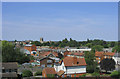
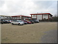
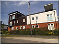
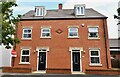
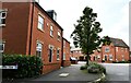
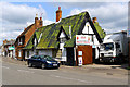
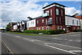
Photos of MK16 9PX


Area Information
Living in MK16 9PX means inhabiting a compact, residential cluster in England with a population of 2143 spread across 3.1 hectares. The area’s high population density of 1410 people per square kilometre reflects its small-scale, closely knit character. Daily life here is shaped by its proximity to essential services and transport links, with a focus on practicality over sprawling urban sprawl. The community is predominantly composed of adults aged 30–64, many of whom own their homes. This demographic suggests a stable, established population with long-term ties to the area. The absence of significant natural or planning constraints means residents benefit from straightforward living conditions, free from environmental restrictions. MK16 9PX is not a place for those seeking wilderness or rural tranquillity, but it offers convenience, accessibility, and a straightforward lifestyle for those prioritising proximity to amenities and infrastructure over open space.
- Area Type
- Postcode
- Area Size
- 3.1 hectares
- Population
- 2143
- Population Density
- 1410 people/km²
MK16 9PX is a predominantly owner-occupied area, with 74% of homes owned by residents rather than rented. The accommodation types here are largely houses, which contrasts with areas where flats or apartments dominate. This suggests a housing stock suited to families or individuals seeking single-unit properties. The small area size and high population density mean the market is limited to a small cluster of homes, with little scope for expansion or new developments. Buyers should consider that the area’s property market is unlikely to cater to investors seeking rental yields, given the focus on owner-occupation. The presence of houses may appeal to those prioritising space and privacy, but the limited size of MK16 9PX means the immediate surroundings are equally constrained. Prospective buyers should evaluate whether the compact nature of the area aligns with their long-term housing needs.
House Prices in MK16 9PX
No properties found in this postcode.
Energy Efficiency in MK16 9PX
MK16 9PX offers a range of nearby amenities within practical reach, including five retail outlets such as M&S Chichley BP, Co-op Newport, and Tesco Newport. These shops provide everyday essentials, making the area convenient for residents who prefer to avoid long trips for groceries or household items. The presence of multiple railway stations ensures easy access to larger towns and cities, while Cranfield Airport adds international travel options. Although the data does not specify parks or leisure facilities, the area’s compact size and proximity to transport links suggest a lifestyle focused on accessibility rather than expansive recreational spaces. The mix of retail and transport options supports a practical, efficient daily life, ideal for those who value convenience over large-scale amenities.
Amenities
Schools
The nearest school to MK16 9PX is Riverside First School, a primary institution. No secondary schools or other educational facilities are listed in the data, so families requiring comprehensive schooling may need to look beyond the immediate area. The presence of a primary school suggests the area is suitable for young children, but parents seeking a full range of educational options will need to consider nearby towns or cities. The absence of additional schools highlights a potential limitation for families requiring multiple levels of education. However, the proximity of Milton Keynes Central Railway Station and other transport links may offset this by providing access to broader schooling networks in adjacent areas.
| Rank | School | Type | Entry gender | Ages |
|---|
Explore more schools in this area
Go to Schools tabDemographics
The population of MK16 9PX has a median age of 47, with the majority of residents falling within the 30–64 age range. This indicates a mature, settled community with a strong presence of middle-aged adults. Home ownership rates are high at 74%, reflecting a preference for long-term residency over rental housing. The area is dominated by houses rather than flats or apartments, suggesting a mix of family homes and single-unit properties. The predominant ethnic group is White, though specific diversity metrics are not provided. The high proportion of adults in the workforce and the lack of data on younger demographics imply a community with limited youth services or student populations. The absence of deprivation data means quality of life can only be inferred from the available figures, but the stability of home ownership and age profile suggests a low turnover of residents and a focus on established living.
Household Size
Accommodation Type
Tenure
Ethnic Group
Religion
Household Composition
Age
Household Deprivation
NS-SEC
Explore more demographic insights in this area
Go to Demographics tabPlanning
Planning Constraints
- Flood RiskPremium
- Ramsar Wetland SitesPremium
- Area of Outstanding Natural BeautyPremium
- Protected Nature ReservePremium
- Protected WoodlandPremium