Area Overview for MK16 9JS
Photos of MK16 9JS
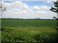
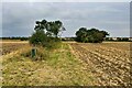
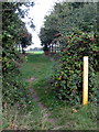
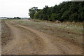
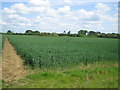
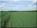
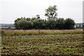
7 photos from this area
Area Information
Key information about the MK16 9JS including its size, population, and administrative classification.
- Area Type
- Postcode
- Area Size
- 1.6 km²
- Population
- 1361
- Population Density
- 37 people/km²
House Prices in MK16 9JS
42
Properties
£454,100
Average Sold Price
£100,000
Lowest Price
£1,750,000
Highest Price
Showing 42 properties
| Address | Type | Beds | Baths | Last Sale Price | Last Sale Date | |
|---|---|---|---|---|---|---|
| Oak Ponds, 33 Main Road, Astwood, MK16 9JS | Detached | 5 | 3 | £750,000 | Sep 2024 | |
| 15 Main Road, Astwood, MK16 9JS | house | 2 | 1 | £378,000 | Oct 2023 | |
| Noel Cottage, 17 Main Road, Astwood, MK16 9JS | Cottage | 3 | 2 | £560,000 | Jul 2023 | |
| Wayside, 39 Main Road, Astwood, MK16 9JS | house | 4 | 2 | £765,000 | Jun 2023 | |
| 3A Main Road, Astwood, MK16 9JS | house | - | - | £1,750,000 | Nov 2021 | |
| Moat House, 35 Main Road, Astwood, MK16 9JS | Detached | 4 | - | £724,000 | Dec 2020 | |
| 31 Main Road, Astwood, MK16 9JS | house | 3 | 1 | £370,000 | Aug 2020 | |
| 37 Main Road, Astwood, MK16 9JS | house | - | - | £465,000 | Nov 2015 | |
| 13 Main Road, Astwood, MK16 9JS | Cottage | 2 | - | £223,000 | Oct 2014 | |
| Tofts, 19 Main Road, Astwood, MK16 9JS | Detached | 4 | - | £435,000 | Aug 2014 |
Page 1 of 5
Energy Efficiency in MK16 9JS
Amenities
Schools
| Rank | School | Type | Entry gender | Ages |
|---|
Explore more schools in this area
Go to Schools tabDemographics
Household Size
Two person
most common
Accommodation Type
Houses
most common
Tenure
74
majority
Ethnic Group
White
most common
Religion
N/A
most common
Household Composition
N/A
most common
Age
47
median
Adults (30-64 years)
most common
Household Deprivation
N/A
with no deprivation
NS-SEC
44
in Lower managerial occupations
Explore more demographic insights in this area
Go to Demographics tabPlanning
Planning Constraints
- Flood RiskPremium
- Ramsar Wetland SitesPremium
- Area of Outstanding Natural BeautyPremium
- Protected Nature ReservePremium