Area Overview for MK16 8LG
Photos of MK16 8LG
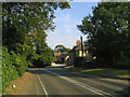

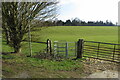


7 photos from this area
Area Information
Key information about the MK16 8LG including its size, population, and administrative classification.
- Area Type
- Postcode
- Area Size
- 2.8 km²
- Population
- 1448
- Population Density
- 52 people/km²
House Prices in MK16 8LG
48
Properties
£497,588
Average Sold Price
£145,000
Lowest Price
£2,500,000
Highest Price
Showing 48 properties
| Address | Type | Beds | Baths | Last Sale Price | Last Sale Date | |
|---|---|---|---|---|---|---|
| 21, Gayhurst House Gayhurst Court, Newport Road, Gayhurst, MK16 8LG | Flat | 3 | 1 | £306,000 | Sep 2021 | |
| 17, Gayhurst House Gayhurst Court, Newport Road, Gayhurst, MK16 8LG | Flat | 2 | 1 | £390,000 | Jun 2021 | |
| 16, Gayhurst House Gayhurst Court, Newport Road, Gayhurst, MK16 8LG | Flat | - | - | £260,000 | Jun 2021 | |
| Keepers Cottage, Newport Road, Gayhurst, MK16 8LG | Detached | 4 | 4 | £850,000 | Apr 2021 | |
| Heron Cottage, Newport Road, Gayhurst, MK16 8LG | house | 3 | 2 | £276,000 | Feb 2021 | |
| Gayhurst Park, Newport Road, Gayhurst, MK16 8LG | Detached | 9 | 7 | £2,500,000 | Dec 2019 | |
| 26, Gayhurst House Gayhurst Court, Newport Road, Gayhurst, MK16 8LG | Flat | - | - | £475,000 | Feb 2018 | |
| 15, Gayhurst House Gayhurst Court, Newport Road, Gayhurst, MK16 8LG | house | - | - | £370,000 | Aug 2016 | |
| 19, Gayhurst House Gayhurst Court, Newport Road, Gayhurst, MK16 8LG | Flat | 4 | - | £720,000 | Sep 2015 | |
| Digby Cottage, Newport Road, Gayhurst, MK16 8LG | Semi-detached | 4 | - | £382,000 | Dec 2014 |
Page 1 of 5
Energy Efficiency in MK16 8LG
Amenities
Schools
| Rank | School | Type | Entry gender | Ages |
|---|
Explore more schools in this area
Go to Schools tabDemographics
Household Size
Two person
most common
Accommodation Type
Houses
most common
Tenure
81
majority
Ethnic Group
White
most common
Religion
N/A
most common
Household Composition
N/A
most common
Age
47
median
Adults (30-64 years)
most common
Household Deprivation
N/A
with no deprivation
NS-SEC
47
in Lower managerial occupations
Explore more demographic insights in this area
Go to Demographics tabPlanning
Planning Constraints
- Flood RiskPremium
- Ramsar Wetland SitesPremium
- Area of Outstanding Natural BeautyPremium
- Protected Nature ReservePremium
- Protected WoodlandPremium