Area Overview for MK15 9LU
Photos of MK15 9LU
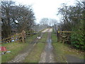
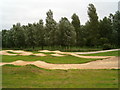


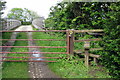
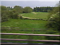

16 photos from this area
Area Information
Key information about the MK15 9LU including its size, population, and administrative classification.
- Area Type
- Postcode
- Area Size
- 2.2 hectares
- Population
- 1330
- Population Density
- 959 people/km²
House Prices in MK15 9LU
16
Properties
£338,676
Average Sold Price
£119,995
Lowest Price
£775,000
Highest Price
Showing 16 properties
| Address | Type | Beds | Baths | Last Sale Price | Last Sale Date | |
|---|---|---|---|---|---|---|
| 28 Aldrich Drive, Willen, Milton Keynes, MK15 9LU | Bungalow | 5 | 3 | £775,000 | Sep 2018 | |
| 34 Aldrich Drive, Willen, Milton Keynes, MK15 9LU | Detached | 5 | - | £750,000 | Apr 2017 | |
| 98 Aldrich Drive, Willen, Milton Keynes, MK15 9LU | house | 4 | - | £307,500 | Aug 2010 | |
| 30 Aldrich Drive, Willen, Milton Keynes, MK15 9LU | house | - | - | £405,000 | Feb 2010 | |
| 32 Aldrich Drive, Willen, Milton Keynes, MK15 9LU | house | - | - | £440,000 | Sep 2009 | |
| 90 Aldrich Drive, Willen, Milton Keynes, MK15 9LU | house | - | - | £298,000 | Aug 2002 | |
| 96 Aldrich Drive, Willen, Milton Keynes, MK15 9LU | Detached | - | - | £165,000 | Aug 2001 | |
| 110 Aldrich Drive, Willen, Milton Keynes, MK15 9LU | house | - | - | £189,950 | Mar 1999 | |
| 92 Aldrich Drive, Willen, Milton Keynes, MK15 9LU | Detached | - | - | £155,000 | Mar 1997 | |
| 94 Aldrich Drive, Willen, Milton Keynes, MK15 9LU | Detached | 4 | 3 | £119,995 | Mar 1997 |
Page 1 of 2
Energy Efficiency in MK15 9LU
Amenities
Schools
| Rank | School | Type | Entry gender | Ages |
|---|
Explore more schools in this area
Go to Schools tabDemographics
Household Size
Two person
most common
Accommodation Type
Houses
most common
Tenure
78
majority
Ethnic Group
White
most common
Religion
N/A
most common
Household Composition
N/A
most common
Age
47
median
Adults (30-64 years)
most common
Household Deprivation
N/A
with no deprivation
NS-SEC
45
in Lower managerial occupations
Explore more demographic insights in this area
Go to Demographics tabPlanning
Planning Constraints
- Flood RiskPremium
- Ramsar Wetland SitesPremium
- Area of Outstanding Natural BeautyPremium
- Protected Nature ReservePremium
- Protected WoodlandPremium