Area Overview for MK15 9HT
Photos of MK15 9HT

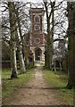
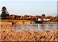
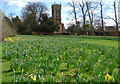


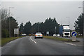


30 photos from this area
Area Information
Key information about the MK15 9HT including its size, population, and administrative classification.
- Area Type
- Postcode
- Area Size
- 1.5 hectares
- Population
- 1330
- Population Density
- 959 people/km²
House Prices in MK15 9HT
17
Properties
£401,829
Average Sold Price
£100,000
Lowest Price
£700,000
Highest Price
Showing 17 properties
| Address | Type | Beds | Baths | Last Sale Price | Last Sale Date | |
|---|---|---|---|---|---|---|
| 2 Millington Gate, Willen, Milton Keynes, MK15 9HT | house | - | - | £700,000 | Feb 2023 | |
| 4 Millington Gate, Willen, Milton Keynes, MK15 9HT | house | - | - | £620,000 | Aug 2021 | |
| 5 Millington Gate, Willen, Milton Keynes, MK15 9HT | Detached | 4 | 2 | £557,000 | Oct 2020 | |
| 8 Millington Gate, Willen, Milton Keynes, MK15 9HT | house | - | - | £600,000 | Dec 2019 | |
| 11 Millington Gate, Willen, Milton Keynes, MK15 9HT | Detached | 4 | 2 | £380,000 | Sep 2013 | |
| 16 Millington Gate, Willen, Milton Keynes, MK15 9HT | house | 4 | - | £415,000 | Aug 2012 | |
| 3 Millington Gate, Willen, Milton Keynes, MK15 9HT | house | 4 | - | £350,000 | Jul 2012 | |
| 13 Millington Gate, Willen, Milton Keynes, MK15 9HT | Detached | 4 | - | £320,000 | Jan 2011 | |
| 18 Millington Gate, Willen, Milton Keynes, MK15 9HT | Detached | - | - | £300,000 | May 2005 | |
| 15 Millington Gate, Willen, Milton Keynes, MK15 9HT | house | 4 | 2 | £315,000 | Feb 2005 |
Page 1 of 2
Energy Efficiency in MK15 9HT
Amenities
Schools
| Rank | School | Type | Entry gender | Ages |
|---|
Explore more schools in this area
Go to Schools tabDemographics
Household Size
Two person
most common
Accommodation Type
Houses
most common
Tenure
78
majority
Ethnic Group
White
most common
Religion
N/A
most common
Household Composition
N/A
most common
Age
47
median
Adults (30-64 years)
most common
Household Deprivation
N/A
with no deprivation
NS-SEC
45
in Lower managerial occupations
Explore more demographic insights in this area
Go to Demographics tabPlanning
Planning Constraints
- Flood RiskPremium
- Ramsar Wetland SitesPremium
- Area of Outstanding Natural BeautyPremium
- Protected Nature ReservePremium
- Protected WoodlandPremium