Area Overview for MK15 9BG
Photos of MK15 9BG


Area Information
MK15 9BG is a small residential postcode area in England, home to around 1,541 people. Its compact size reflects a focused, community-oriented layout, typical of areas prioritising housing over commercial development. The area’s character is defined by its proximity to key transport links, including multiple railway stations and Cranfield Airport, which sit within practical reach for residents. Daily life here is shaped by the balance between suburban tranquillity and accessible connectivity. With a median age of 47, the population skews towards adults in their 30s to 60s, suggesting a stable, family-oriented demographic. The area’s housing stock, dominated by individual homes, caters to those seeking private, low-density living. While it lacks the density of larger urban centres, its strategic location near Milton Keynes offers access to broader amenities without the congestion of city life. For those valuing a quieter lifestyle with reliable transport options, MK15 9BG presents a compelling blend of residential comfort and practicality.
- Area Type
- Postcode
- Area Size
- Not available
- Population
- 1541
- Population Density
- 3474 people/km²
MK15 9BG is primarily an owner-occupied area, with 70% of properties in private hands. This high rate of home ownership suggests a stable market with long-term residents who are less likely to rent out properties, which can influence local demand and prices. The accommodation type is predominantly houses, which contrasts with areas where flats or apartments dominate. This indicates a preference for standalone homes, likely appealing to families or those seeking more space. Given the small size of the postcode area, the housing stock is limited, meaning buyers should consider nearby regions for additional options. The focus on owner-occupation also implies that rental properties are less common, which could affect availability for tenants. For those seeking a home in MK15 9BG, the emphasis on houses and low turnover suggests a market that prioritises permanence over flexibility.
House Prices in MK15 9BG
No properties found in this postcode.
Energy Efficiency in MK15 9BG
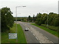
Living in MK15 9BG offers access to a range of amenities within practical reach. Retail options include major chains such as Sainsburys Milton Keynes and Co-op outlets, providing convenience for daily shopping. The area’s rail network, with stations like Milton Keynes Central and Fenny Stratford, connects residents to nearby towns and cities, facilitating both work and leisure travel. Cranfield Airport, though not a major hub, serves as a practical option for those requiring air travel. The presence of multiple retail points and transport links suggests a lifestyle that balances local self-sufficiency with regional accessibility. While the area itself is small, its integration with Milton Keynes ensures that residents are never far from larger amenities. The combination of shops, transport, and nearby airports creates a functional, if modest, environment for daily life.
Amenities
Schools
| Rank | School | Type | Entry gender | Ages |
|---|
Explore more schools in this area
Go to Schools tabDemographics
The community in MK15 9BG is predominantly composed of adults aged 30–64, with a median age of 47. This suggests a mature, established population, likely with long-term ties to the area. Home ownership is high, with 70% of residents owning their properties, indicating a stable housing market and a preference for long-term residency. The area’s accommodation is largely made up of houses rather than flats, aligning with the demographic’s focus on family living. The predominant ethnic group is White, reflecting broader trends in the region. While no specific data on deprivation is provided, the high home ownership rate and low crime risk suggest a relatively affluent and secure environment. The absence of detailed diversity metrics means the community’s full composition remains less defined, but the figures available point to a cohesive, settled population.
Household Size
Accommodation Type
Tenure
Ethnic Group
Religion
Household Composition
Age
Household Deprivation
NS-SEC
Explore more demographic insights in this area
Go to Demographics tabPlanning
Planning Constraints
- Flood RiskPremium
- Ramsar Wetland SitesPremium
- Area of Outstanding Natural BeautyPremium
- Protected Nature ReservePremium
- Protected WoodlandPremium