Area Overview for MK15 8HN
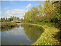
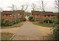
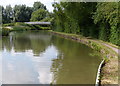
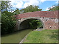
Photos of MK15 8HN


Area Information
Living in MK15 8HN means inhabiting a compact, residential postcode area that balances density with a sense of community. Covering just 3,107 square metres, the area is small but efficiently planned, housing 1,325 residents at a population density of 1,116 people per square kilometre. This suggests a tightly knit neighbourhood where daily life is shaped by proximity to local amenities and transport links. The area is not a sprawling suburb but a focused cluster, ideal for those seeking convenience without the sprawl of larger towns. Its location likely benefits from nearby infrastructure, including retail hubs and rail connections, which make it practical for commuters and families alike. The demographic profile—predominantly adults aged 30–64, with a median age of 47—hints at a mature, settled community. Home ownership is high at 77%, indicating long-term residency and investment in property. For buyers, this area offers a blend of stability and accessibility, though its small size means the housing stock is limited to a specific set of properties.
- Area Type
- Postcode
- Area Size
- 3107 m²
- Population
- 1325
- Population Density
- 1116 people/km²
The property market in MK15 8HN is characterised by high home ownership—77% of residents own their homes—suggesting a community of long-term residents rather than a transient rental market. The predominant accommodation type is houses, which indicates a focus on family homes and single-family dwellings. This aligns with the area’s demographic profile, where the majority of residents are adults aged 30–64, likely including couples and families. The small size of the postcode area—just 3,107 square metres—means the housing stock is limited, and buyers should expect a constrained selection of properties. The high ownership rate also implies that rental availability is limited, which could be a consideration for those seeking to rent. For buyers, this area offers a chance to invest in a stable, owner-occupied market, though the compact nature of the postcode means the immediate surroundings are key to finding additional options.
House Prices in MK15 8HN
No properties found in this postcode.
Energy Efficiency in MK15 8HN
The lifestyle in MK15 8HN is shaped by its proximity to essential amenities. Within practical reach are five retail outlets, including Sainsburys Milton Keynes, Tesco Giffard, and Spar, offering everyday shopping needs. The railway stations—Milton Keynes Central, Wolverton, and Bow Brickhill—provide easy access to public transport, connecting residents to the city centre and further afield. Cranfield Airport, though not a major hub, may cater to specific travel needs. The area’s compact size means these amenities are close, reducing the necessity for long trips. While the data does not mention parks or leisure facilities, the presence of multiple retail and transport hubs suggests a focus on practicality over leisure. For residents, this means a lifestyle prioritising convenience, with daily errands and travel efficiently managed without the need for extensive car use.
Amenities
Schools
| Rank | School | Type | Entry gender | Ages |
|---|
Explore more schools in this area
Go to Schools tabDemographics
The community in MK15 8HN is defined by its age profile, with a median age of 47 and the majority of residents falling within the 30–64 age range. This suggests a population skewed toward middle-aged adults, likely including families and professionals. Home ownership is strong at 77%, reflecting a community where most residents are long-term property owners rather than renters. The accommodation type is predominantly houses, which aligns with the demographic of established households. The predominant ethnic group is White, which is consistent with broader trends in Milton Keynes but offers insight into the cultural makeup of the area. While no specific data on deprivation is provided, the high home ownership rate and low crime score (74/100) imply a relatively stable and secure environment. However, the lack of detailed diversity metrics means the full extent of the community’s social composition remains unexplored.
Household Size
Accommodation Type
Tenure
Ethnic Group
Religion
Household Composition
Age
Household Deprivation
NS-SEC
Explore more demographic insights in this area
Go to Demographics tabPlanning
Planning Constraints
- Flood RiskPremium
- Ramsar Wetland SitesPremium
- Area of Outstanding Natural BeautyPremium
- Protected Nature ReservePremium
- Protected WoodlandPremium