Area Overview for MK14 6NZ
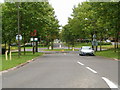
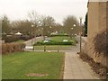
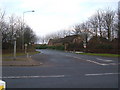
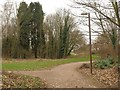
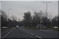
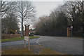
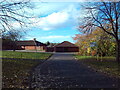
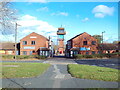
Photos of MK14 6NZ
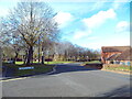
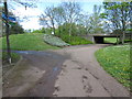
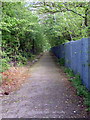
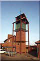
Area Information
Living in MK14 6NZ offers a quiet, residential lifestyle within a small cluster of homes. With a population of 1,368, the area is compact but well-served by essential amenities. The community is predominantly composed of adults aged 30–64, reflecting a mature, stable demographic. Daily life here balances convenience with tranquillity, with easy access to nearby schools, rail stations, and retail outlets. The area’s proximity to Milton Keynes Central Railway Station and Wolverton Station ensures reliable commuting options, while the Co-op stores in the vicinity provide practical shopping solutions. Though small, MK14 6NZ is positioned to benefit from regional connectivity, with Cranfield Airport within reach. The housing stock, primarily composed of houses, suggests a focus on family-friendly living, though the modest size of the area means buyers should consider nearby options for expansion. For those seeking a low-maintenance, community-oriented environment, MK14 6NZ offers a blend of practicality and accessibility.
- Area Type
- Postcode
- Area Size
- Not available
- Population
- 1368
- Population Density
- 4045 people/km²
The property market in MK14 6NZ is defined by a 53% home ownership rate, suggesting a balance between owner-occupied and rental properties. The accommodation type is primarily houses, which is unusual for areas with higher apartment or flat density. This indicates a focus on single-family homes, potentially catering to families or individuals prioritising private space. Given the small size of the area, the housing stock is limited, which may mean buyers need to consider nearby postcode areas for more options. The presence of houses rather than flats could also influence property values, with demand from those seeking larger living spaces. For investors, the mix of ownership and rental properties may offer opportunities, but the small scale of the area means competition for available properties is likely. Buyers should assess whether the existing housing stock meets their specific needs, particularly if they require modern or specialist accommodation.
House Prices in MK14 6NZ
No properties found in this postcode.
Energy Efficiency in MK14 6NZ
The lifestyle in MK14 6NZ is shaped by its proximity to retail, rail, and regional travel. Local shops include Co-op Neath, The Southern Co-operative Co, and Co-op Great, providing everyday essentials. The five nearby rail stations, including Milton Keynes Central and Wolverton, offer easy access to urban centres, while Cranfield Airport serves those requiring air travel. Though the data does not mention parks or leisure facilities, the presence of multiple retail outlets and transport links suggests a practical, convenience-driven environment. The area’s small size means amenities are concentrated, reducing the need for long commutes. For residents prioritising accessibility over expansive recreational spaces, MK14 6NZ delivers a functional, well-connected lifestyle with minimal effort.
Amenities
Schools
Residents of MK14 6NZ have access to several primary schools, including Brooksward Middle School, Brooksward First School, and St Monica’s Catholic Primary School, which holds an Ofsted rating of ‘good’. Brooksward School operates as both a primary school and an academy, offering varied educational pathways. The concentration of primary schools suggests the area is well-suited for families with young children, though no secondary schools are listed in the data. The presence of multiple school types, including a Catholic institution, may provide parents with choices aligned with their preferences. However, the lack of secondary education options nearby could necessitate commuting for older students. Overall, the school infrastructure supports early education needs, but prospective buyers should consider additional schooling provisions beyond primary level.
| Rank | School | Type | Entry gender | Ages |
|---|
Explore more schools in this area
Go to Schools tabDemographics
The community in MK14 6NZ is characterised by a median age of 47, with the majority of residents falling within the 30–64 age range. This suggests a population skewed towards middle-aged adults, likely with established careers and families. Home ownership stands at 53%, indicating a mix of owner-occupied properties and rental units. The accommodation type is predominantly houses, which may appeal to those seeking more space or a traditional living arrangement. The predominant ethnic group is White, though no specific data on diversity or deprivation is provided. The age profile implies a stable, long-term resident base, with fewer young families or retirees compared to other areas. This demographic structure may influence local services and amenities, aligning them with the needs of working-age adults and middle-aged households.
Household Size
Accommodation Type
Tenure
Ethnic Group
Religion
Household Composition
Age
Household Deprivation
NS-SEC
Explore more demographic insights in this area
Go to Demographics tabPlanning
Planning Constraints
- Flood RiskPremium
- Ramsar Wetland SitesPremium
- Area of Outstanding Natural BeautyPremium
- Protected Nature ReservePremium
- Protected WoodlandPremium