Area Overview for MK14 6LF
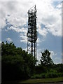
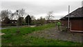
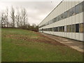
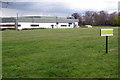
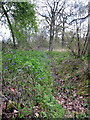
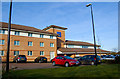
Photos of MK14 6LF


Area Information
Living in MK14 6LF means inhabiting a tightly packed residential cluster in Milton Keynes, where 1,864 people reside across 3.3 hectares. The area’s high population density of 1,169 people per square kilometre reflects a compact, possibly family-oriented community. Proximity to schools, rail links, and retail hubs makes it practical for daily life, though the small footprint limits expansion. The area’s character is defined by its proximity to educational institutions and transport networks, which may appeal to commuters or families prioritising convenience. With a median age of 47 and a population skewed toward adults aged 30–64, the community likely balances active professionals with retirees. While the data does not specify cultural diversity, the predominant ethnic group is White, suggesting a homogenous demographic. For buyers, MK14 6LF offers a snapshot of suburban living with limited space but strong connectivity to Milton Keynes’ broader infrastructure.
- Area Type
- Postcode
- Area Size
- 3.3 hectares
- Population
- 1864
- Population Density
- 1169 people/km²
The property market in MK14 6LF is characterised by a low home ownership rate of 33%, indicating that most residents rent their homes. The accommodation type is predominantly houses, which may reflect a preference for single-family dwellings in a compact area. Given the small size of the postcode—just 3.3 hectares—the housing stock is limited, and buyers may need to look beyond MK14 6LF for more options. The high population density of 1,169 people per square kilometre suggests that properties are closely spaced, potentially leading to competition for available homes. For buyers, this area may be more suited to those seeking rental properties or investing in a niche market. The lack of significant planning constraints, aside from protected woodland, means development is unlikely to expand the housing supply. Prospective buyers should consider the limited availability and the need for proximity to transport and schools when evaluating properties here.
House Prices in MK14 6LF
No properties found in this postcode.
Energy Efficiency in MK14 6LF
Residents of MK14 6LF have access to five retail venues, including Co-op Great, Aldi Stantonbury, and The Southern Co-operative Co, offering everyday shopping needs. The area’s proximity to three railway stations—Milton Keynes Central, Wolverton, and Fenny Stratford—provides easy access to broader networks, though no specific leisure or dining venues are listed. The compact size of the postcode means amenities are concentrated, which could be practical for daily life but may limit variety. The presence of multiple schools and transport links suggests a focus on functionality over leisure. While the data does not specify parks or recreational spaces, the absence of protected natural areas or AONB coverage implies that green spaces may be limited. The lifestyle here is defined by proximity to essential services and transport, with a trade-off between convenience and the potential lack of expansive amenities.
Amenities
Schools
MK14 6LF is served by several schools, including Stantonbury Campus and Stantonbury Campus South, both primary schools. The Webber Independent School offers an independent education option, while Stantonbury International and Stantonbury School are academies. The latter has an Ofsted rating of satisfactory, which may indicate a moderate standard of education. The mix of state and independent schools provides families with choices, though the independent option may come with higher costs. The presence of multiple primary schools suggests a focus on early education, which could be a draw for families. However, no secondary schools are listed, so parents may need to consider nearby areas for comprehensive schooling. The availability of academies and independent schools reflects a diverse educational landscape, though the overall quality depends on individual school performance.
| Rank | School | Type | Entry gender | Ages |
|---|
Explore more schools in this area
Go to Schools tabDemographics
MK14 6LF has a median age of 47, with the majority of residents aged between 30 and 64. This suggests a population skewed toward middle-aged adults, possibly including working professionals and families. Only 33% of homes are owner-occupied, indicating a rental market dominance. The accommodation type is predominantly houses, which may reflect a preference for single-family living. The predominant ethnic group is White, though specific diversity metrics are not provided. The high population density of 1,169 people per square kilometre implies a closely packed community, which could influence local amenities and social dynamics. While no deprivation data is included, the low home ownership rate might suggest economic pressures or a transient population. The age profile and housing stock suggest a stable but not rapidly growing area, where daily life is shaped by proximity to schools and transport rather than expansive green spaces.
Household Size
Accommodation Type
Tenure
Ethnic Group
Religion
Household Composition
Age
Household Deprivation
NS-SEC
Explore more demographic insights in this area
Go to Demographics tabPlanning
Planning Constraints
- Flood RiskPremium
- Ramsar Wetland SitesPremium
- Area of Outstanding Natural BeautyPremium
- Protected Nature ReservePremium
- Protected WoodlandPremium