Area Overview for MK14 5YY
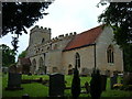
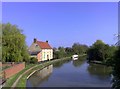
Photos of MK14 5YY


Area Information
Living in MK14 5YY offers a quiet, residential experience in a small cluster of homes with a population of 1,297. This area is defined by its compact size and proximity to essential services, making it ideal for those seeking a balanced lifestyle. The community is predominantly composed of adults aged 30–64, reflecting a mature, stable demographic. Daily life here is shaped by the availability of nearby amenities, including retail outlets and rail connections, which support both practical needs and commuting. The area’s low crime risk and absence of environmental constraints, such as protected woodlands or flood-prone zones, contribute to a sense of security. While it lacks the density of larger urban centres, MK14 5YY provides a peaceful environment with direct access to local schools, rail links, and digital connectivity. Its small scale means a tight-knit community feel, where residents are likely to know their neighbours. For buyers, this area represents a blend of practicality and tranquillity, though its limited size may restrict options for those seeking larger properties or more expansive living spaces.
- Area Type
- Postcode
- Area Size
- Not available
- Population
- 1297
- Population Density
- 1364 people/km²
The property market in MK14 5YY is characterised by a high rate of home ownership (85%), with houses being the primary accommodation type. This suggests a community where long-term residency is common, and property values are likely to reflect the stability of the area. The small size of the postcode area means the housing stock is limited, which may result in a competitive market for buyers. With no rental data provided, it is unclear whether the area also attracts tenants, but the high home ownership rate implies that most properties are owner-occupied. For buyers, this means a focus on purchasing rather than renting, which could influence availability and pricing. The predominance of houses over flats or apartments may appeal to those seeking family-friendly homes, though the limited size of the area could restrict options for those requiring larger properties or those looking to invest in multiple properties.
House Prices in MK14 5YY
No properties found in this postcode.
Energy Efficiency in MK14 5YY
MK14 5YY’s lifestyle is supported by nearby amenities, including five retail outlets such as Tesco Giffard, Lidl Newport, and Waitrose. These shops provide convenient access to groceries and daily essentials, reducing the need for long trips to larger centres. The area’s rail stations offer direct connections to Milton Keynes and beyond, making it easy to reach cultural and leisure opportunities in nearby towns. While specific parks or recreational facilities are not listed in the data, the proximity to rail links and retail hubs suggests a lifestyle that balances local convenience with broader connectivity. The presence of a well-rated primary school and accessible transport options further enhance the area’s appeal for families and professionals. Overall, MK14 5YY offers a practical, community-focused environment where daily needs are met without the need for extensive travel.
Amenities
Schools
The nearest school to MK14 5YY is Giffard Park Primary School, which serves the local community with a good Ofsted rating. This school is a key consideration for families in the area, offering a reliable primary education within walking distance. The absence of secondary schools in the immediate vicinity means residents may need to travel to nearby towns for further education, but the quality of the primary school suggests a strong foundation for children’s learning. The school’s good rating indicates effective teaching and facilities, which is crucial for parents prioritising educational standards. Given the area’s focus on family living, the presence of a well-regarded primary school enhances its appeal, though prospective buyers should consider the need for additional schooling options beyond primary level.
| Rank | School | Type | Entry gender | Ages |
|---|
Explore more schools in this area
Go to Schools tabDemographics
MK14 5YY’s population of 1,297 is predominantly composed of adults aged 30–64, with a median age of 47. This suggests a community of established professionals and families, rather than a younger or elderly demographic. Home ownership is high, with 85% of residents living in owner-occupied homes, indicating a stable housing market. The accommodation type is primarily houses, which aligns with the area’s small, residential character. The predominant ethnic group is White, reflecting a homogenous population profile. While specific data on deprivation is not provided, the high home ownership rate and low crime risk suggest a relatively affluent and secure environment. The absence of detailed diversity statistics means the area’s social composition remains largely unexamined in public records, but the demographic data points to a community focused on long-term residency and family life.
Household Size
Accommodation Type
Tenure
Ethnic Group
Religion
Household Composition
Age
Household Deprivation
NS-SEC
Explore more demographic insights in this area
Go to Demographics tabPlanning
Planning Constraints
- Flood RiskPremium
- Ramsar Wetland SitesPremium
- Area of Outstanding Natural BeautyPremium
- Protected Nature ReservePremium
- Protected WoodlandPremium