Area Overview for MK14 5ED
Photos of MK14 5ED
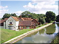

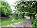
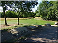
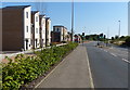


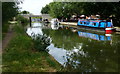
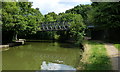
36 photos from this area
Area Information
Key information about the MK14 5ED including its size, population, and administrative classification.
- Area Type
- Postcode
- Area Size
- 4.9 hectares
- Population
- 1329
- Population Density
- 2183 people/km²
House Prices in MK14 5ED
48
Properties
£171,118
Average Sold Price
£21,600
Lowest Price
£268,500
Highest Price
Showing 48 properties
| Address | Type | Beds | Baths | Last Sale Price | Last Sale Date | |
|---|---|---|---|---|---|---|
| 69 Church Lees, Great Linford, Milton Keynes, MK14 5ED | Terraced | 3 | 1 | £268,500 | Feb 2023 | |
| 52 Church Lees, Great Linford, Milton Keynes, MK14 5ED | house | - | - | £240,000 | Jan 2021 | |
| 77 Church Lees, Great Linford, Milton Keynes, MK14 5ED | Terraced | 3 | 1 | £192,000 | Sep 2020 | |
| 68 Church Lees, Great Linford, Milton Keynes, MK14 5ED | house | - | - | £215,000 | Dec 2019 | |
| 61 Church Lees, Great Linford, Milton Keynes, MK14 5ED | Terraced | 3 | 1 | £252,500 | Aug 2019 | |
| 55 Church Lees, Great Linford, Milton Keynes, MK14 5ED | Terraced | 3 | 2 | £226,650 | Jun 2019 | |
| 37 Church Lees, Great Linford, Milton Keynes, MK14 5ED | Terraced | 3 | 1 | £223,000 | Jul 2018 | |
| 56 Church Lees, Great Linford, Milton Keynes, MK14 5ED | Terraced | 3 | 1 | £220,000 | Jun 2018 | |
| 54 Church Lees, Great Linford, Milton Keynes, MK14 5ED | house | 3 | 1 | £160,000 | May 2015 | |
| 46 Church Lees, Great Linford, Milton Keynes, MK14 5ED | Terraced | 3 | - | £184,995 | Feb 2015 |
Page 1 of 5
Energy Efficiency in MK14 5ED
Amenities
Schools
| Rank | School | Type | Entry gender | Ages |
|---|
Explore more schools in this area
Go to Schools tabDemographics
Household Size
Two person
most common
Accommodation Type
Houses
most common
Tenure
66
majority
Ethnic Group
White
most common
Religion
N/A
most common
Household Composition
N/A
most common
Age
47
median
Adults (30-64 years)
most common
Household Deprivation
N/A
with no deprivation
NS-SEC
38
in Lower managerial occupations
Explore more demographic insights in this area
Go to Demographics tabPlanning
Planning Constraints
- Flood RiskPremium
- Ramsar Wetland SitesPremium
- Area of Outstanding Natural BeautyPremium
- Protected Nature ReservePremium
- Protected WoodlandPremium