Area Overview for MK14 5AS
Photos of MK14 5AS
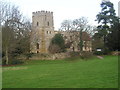
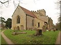
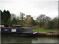
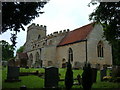
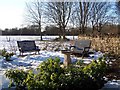
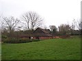
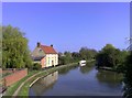
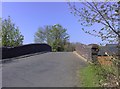
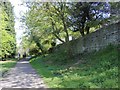

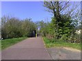
86 photos from this area
Area Information
Key information about the MK14 5AS including its size, population, and administrative classification.
- Area Type
- Postcode
- Area Size
- 2.4 hectares
- Population
- 1329
- Population Density
- 2183 people/km²
House Prices in MK14 5AS
11
Properties
£455,000
Average Sold Price
£185,000
Lowest Price
£940,000
Highest Price
Showing 11 properties
| Address | Type | Beds | Baths | Last Sale Price | Last Sale Date | |
|---|---|---|---|---|---|---|
| Staith Cottage, 4 The Wharf, Great Linford, Milton Keynes, MK14 5AS | Detached | 4 | 3 | £940,000 | Sep 2025 | |
| 11 The Wharf, Great Linford, Milton Keynes, MK14 5AS | Terraced | 2 | 1 | £270,000 | Dec 2023 | |
| Canal Cottage, The Wharf, Great Linford, Milton Keynes, MK14 5AS | house | - | - | £670,000 | Sep 2016 | |
| 10 The Wharf, Great Linford, Milton Keynes, MK14 5AS | Semi-detached | 1 | 1 | £185,000 | Mar 2016 | |
| 12 The Wharf, Great Linford, Milton Keynes, MK14 5AS | Terraced | - | - | £210,000 | Feb 2008 | |
| 3 The Wharf, Great Linford, Milton Keynes, MK14 5AS | Bungalow | 4 | 3 | - | - | |
| The Old Wharf House, The Wharf, Great Linford, Milton Keynes, MK14 5AS | Detached | 6 | - | - | - | |
| 9 The Wharf, Great Linford, Milton Keynes, MK14 5AS | house | - | - | - | - | |
| Ash House, The Wharf, Great Linford, Milton Keynes, MK14 5AS | Detached | - | - | - | - | |
| 6 The Wharf, Great Linford, Milton Keynes, MK14 5AS | house | - | - | - | - |
Page 1 of 2
Energy Efficiency in MK14 5AS
Amenities
Schools
| Rank | School | Type | Entry gender | Ages |
|---|
Explore more schools in this area
Go to Schools tabDemographics
Household Size
Two person
most common
Accommodation Type
Houses
most common
Tenure
66
majority
Ethnic Group
White
most common
Religion
N/A
most common
Household Composition
N/A
most common
Age
47
median
Adults (30-64 years)
most common
Household Deprivation
N/A
with no deprivation
NS-SEC
38
in Lower managerial occupations
Explore more demographic insights in this area
Go to Demographics tabPlanning
Planning Constraints
- Flood RiskPremium
- Ramsar Wetland SitesPremium
- Area of Outstanding Natural BeautyPremium
- Protected Nature ReservePremium
- Protected WoodlandPremium