Area Overview for MK14 5AB
Photos of MK14 5AB
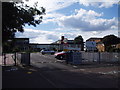


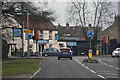
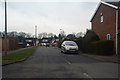
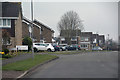
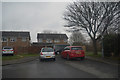

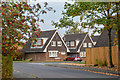
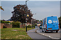


28 photos from this area
Area Information
Key information about the MK14 5AB including its size, population, and administrative classification.
- Area Type
- Postcode
- Area Size
- 2.4 hectares
- Population
- 1297
- Population Density
- 1364 people/km²
House Prices in MK14 5AB
16
Properties
£381,375
Average Sold Price
£139,000
Lowest Price
£635,000
Highest Price
Showing 16 properties
| Address | Type | Beds | Baths | Last Sale Price | Last Sale Date | |
|---|---|---|---|---|---|---|
| 216 Wolverton Road, Blakelands, Milton Keynes, MK14 5AB | Semi-detached | 3 | 2 | £467,000 | Jun 2024 | |
| 230 Wolverton Road, Blakelands, Milton Keynes, MK14 5AB | Bungalow | 4 | 3 | £635,000 | Feb 2024 | |
| 224 Wolverton Road, Blakelands, Milton Keynes, MK14 5AB | Detached | 4 | 2 | £615,000 | Jun 2021 | |
| 218 Wolverton Road, Blakelands, Milton Keynes, MK14 5AB | house | 4 | - | £335,000 | May 2012 | |
| 226 Wolverton Road, Blakelands, Milton Keynes, MK14 5AB | house | 4 | - | £500,000 | Jul 2011 | |
| 214 Wolverton Road, Blakelands, Milton Keynes, MK14 5AB | Semi-detached | - | - | £150,000 | Jul 2002 | |
| 234 Wolverton Road, Blakelands, Milton Keynes, MK14 5AB | Detached | - | - | £210,000 | Mar 2000 | |
| 232 Wolverton Road, Blakelands, Milton Keynes, MK14 5AB | house | - | - | £139,000 | Jul 1997 | |
| 220C Wolverton Road, Blakelands, Milton Keynes, MK14 5AB | Detached | 4 | 1 | - | - | |
| 222B Wolverton Road, Blakelands, Milton Keynes, MK14 5AB | Detached | 4 | 3 | - | - |
Page 1 of 2
Energy Efficiency in MK14 5AB
Amenities
Schools
| Rank | School | Type | Entry gender | Ages |
|---|
Explore more schools in this area
Go to Schools tabDemographics
Household Size
Two person
most common
Accommodation Type
Houses
most common
Tenure
85
majority
Ethnic Group
White
most common
Religion
N/A
most common
Household Composition
N/A
most common
Age
47
median
Adults (30-64 years)
most common
Household Deprivation
N/A
with no deprivation
NS-SEC
45
in Lower managerial occupations
Explore more demographic insights in this area
Go to Demographics tabPlanning
Planning Constraints
- Flood RiskPremium
- Ramsar Wetland SitesPremium
- Area of Outstanding Natural BeautyPremium
- Protected Nature ReservePremium
- Protected WoodlandPremium