Area Overview for MK13 8PB
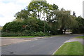
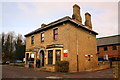
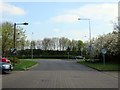
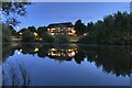
Photos of MK13 8PB


Area Information
MK13 8PB is a small, tightly knit residential area in Milton Keynes, England, home to 1,792 people. Its compact size fosters a sense of familiarity, with residents often knowing their neighbours. The area is predominantly composed of houses, reflecting a more traditional housing stock compared to larger urban centres. With a median age of 47, the community is largely made up of adults aged 30–64, suggesting a stable population of professionals, families, and retirees. While the area lacks the density of a city, its proximity to key transport hubs and retail centres offers convenience without the bustle of a metropolis. The low flood risk and absence of protected natural sites make it a practical choice for families seeking security and ease of access to amenities. However, the high crime risk score of 29 means residents should consider additional security measures. For those prioritising a quiet, manageable community with practical infrastructure, MK13 8PB offers a balance of residential comfort and connectivity.
- Area Type
- Postcode
- Area Size
- Not available
- Population
- 1792
- Population Density
- 2472 people/km²
MK13 8PB is a predominantly rental market, with only 39% of homes owned by residents. The housing stock consists mainly of houses, which contrasts with areas where flats or apartments dominate. This suggests a focus on single-family homes, likely appealing to those seeking space and privacy. However, the small size of the area means property availability is limited, and buyers should consider the broader Milton Keynes region for more options. The lower home ownership rate may indicate a transient population or a preference for renting in a location with strong transport links. For those interested in purchasing, the area’s houses may offer long-term value, though competition for properties could be fierce due to its manageable size and amenities.
House Prices in MK13 8PB
No properties found in this postcode.
Energy Efficiency in MK13 8PB
Living in MK13 8PB offers access to a range of practical amenities within reach. The area is served by five retail outlets, including Aldi, Tesco Milton, and Morrisons Milton, ensuring everyday shopping needs are met without long journeys. The proximity to five railway stations—Milton Keynes Central, Wolverton, and Bletchley—provides swift connections to nearby towns and cities, enhancing both commuting and social opportunities. While the data does not specify parks or leisure facilities, the retail and transport infrastructure suggests a focus on convenience over expansive recreational spaces. The presence of multiple supermarkets and rail links indicates a lifestyle prioritising accessibility and efficiency, ideal for those who value practicality in their daily routines.
Amenities
Schools
| Rank | School | Type | Entry gender | Ages |
|---|
Explore more schools in this area
Go to Schools tabDemographics
The population of MK13 8PB is 1,792, with a median age of 47. Over half the residents are aged 30–64, indicating a mature demographic skewed towards established professionals and families. Home ownership is relatively low at 39%, suggesting that a significant portion of the population rents, which may reflect the area’s appeal to transient or younger households. The predominant accommodation type is houses, aligning with the residential character of the postcode. The predominant ethnic group is White, with no specific data provided on other demographics. This age profile and ownership rate suggest a community that values stability but may lack the vibrancy of younger, more diverse areas. The absence of deprivation data means it is unclear how economic factors influence quality of life, though the low flood risk and proximity to amenities hint at practical living conditions.
Household Size
Accommodation Type
Tenure
Ethnic Group
Religion
Household Composition
Age
Household Deprivation
NS-SEC
Explore more demographic insights in this area
Go to Demographics tabPlanning
Planning Constraints
- Flood RiskPremium
- Ramsar Wetland SitesPremium
- Area of Outstanding Natural BeautyPremium
- Protected Nature ReservePremium
- Protected WoodlandPremium