Area Overview for MK13 7LH
Photos of MK13 7LH


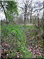

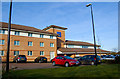


12 photos from this area
Area Information
Key information about the MK13 7LH including its size, population, and administrative classification.
- Area Type
- Postcode
- Area Size
- 1.3 hectares
- Population
- 1668
- Population Density
- 5907 people/km²
House Prices in MK13 7LH
36
Properties
£163,917
Average Sold Price
£58,000
Lowest Price
£299,000
Highest Price
Showing 36 properties
| Address | Type | Beds | Baths | Last Sale Price | Last Sale Date | |
|---|---|---|---|---|---|---|
| 30 Arncliffe Drive, Heelands, Milton Keynes, MK13 7LH | Bungalow | 2 | 1 | £255,000 | Jul 2025 | |
| 48 Arncliffe Drive, Heelands, Milton Keynes, MK13 7LH | Semi-detached | 4 | 1 | £299,000 | Jan 2024 | |
| 56 Arncliffe Drive, Heelands, Milton Keynes, MK13 7LH | Terraced | 2 | 1 | £182,000 | Nov 2019 | |
| 52 Arncliffe Drive, Heelands, Milton Keynes, MK13 7LH | Terraced | 2 | - | £205,000 | Dec 2017 | |
| 12 Arncliffe Drive, Heelands, Milton Keynes, MK13 7LH | Terraced | 3 | 1 | £150,000 | Nov 2017 | |
| 26 Arncliffe Drive, Heelands, Milton Keynes, MK13 7LH | Bungalow | 3 | - | £160,000 | Oct 2016 | |
| 44 Arncliffe Drive, Heelands, Milton Keynes, MK13 7LH | house | 3 | - | £127,000 | Dec 2011 | |
| 64 Arncliffe Drive, Heelands, Milton Keynes, MK13 7LH | Semi-detached | 3 | 1 | £150,000 | Sep 2010 | |
| 66 Arncliffe Drive, Heelands, Milton Keynes, MK13 7LH | Terraced | 3 | 1 | £120,000 | Mar 2007 | |
| 42 Arncliffe Drive, Heelands, Milton Keynes, MK13 7LH | Semi-detached | - | - | £135,000 | Mar 2004 |
Page 1 of 4
Energy Efficiency in MK13 7LH
Amenities
Schools
| Rank | School | Type | Entry gender | Ages |
|---|
Explore more schools in this area
Go to Schools tabDemographics
Household Size
Family (3-5 people)
most common
Accommodation Type
Houses
most common
Tenure
59
majority
Ethnic Group
White
most common
Religion
N/A
most common
Household Composition
N/A
most common
Age
47
median
Adults (30-64 years)
most common
Household Deprivation
N/A
with no deprivation
NS-SEC
24
in Lower managerial occupations
Explore more demographic insights in this area
Go to Demographics tabPlanning
Planning Constraints
- Flood RiskPremium
- Ramsar Wetland SitesPremium
- Area of Outstanding Natural BeautyPremium
- Protected Nature ReservePremium
- Protected WoodlandPremium