Area Overview for MK13 7AZ
Photos of MK13 7AZ
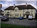
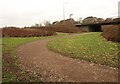
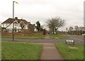
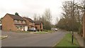

15 photos from this area
Area Information
Key information about the MK13 7AZ including its size, population, and administrative classification.
- Area Type
- Postcode
- Area Size
- 3.2 hectares
- Population
- 1805
- Population Density
- 4460 people/km²
House Prices in MK13 7AZ
52
Properties
£176,648
Average Sold Price
£38,000
Lowest Price
£302,000
Highest Price
Showing 52 properties
| Address | Type | Beds | Baths | Last Sale Price | Last Sale Date | |
|---|---|---|---|---|---|---|
| 79 Cleveland, Bradville, Milton Keynes, MK13 7AZ | house | - | - | £277,000 | Aug 2025 | |
| 19 Cleveland, Bradville, Milton Keynes, MK13 7AZ | Detached | 3 | 1 | £265,000 | Jun 2025 | |
| 81 Cleveland, Bradville, Milton Keynes, MK13 7AZ | Terraced | 3 | 1 | £290,000 | Feb 2025 | |
| 99 Cleveland, Bradville, Milton Keynes, MK13 7AZ | Terraced | 3 | 1 | £299,995 | Dec 2023 | |
| 23 Cleveland, Bradville, Milton Keynes, MK13 7AZ | Semi-detached | 2 | - | £175,200 | Nov 2023 | |
| 61 Cleveland, Bradville, Milton Keynes, MK13 7AZ | Semi-detached | 3 | 1 | £240,000 | Oct 2022 | |
| 5 Cleveland, Bradville, Milton Keynes, MK13 7AZ | house | 3 | 1 | £302,000 | Mar 2022 | |
| 3 Cleveland, Bradville, Milton Keynes, MK13 7AZ | Semi-detached | 3 | 1 | £267,000 | Jan 2022 | |
| 83 Cleveland, Bradville, Milton Keynes, MK13 7AZ | house | - | - | £192,000 | Jan 2022 | |
| 57 Cleveland, Bradville, Milton Keynes, MK13 7AZ | house | 3 | - | £240,000 | May 2021 |
Page 1 of 6
Energy Efficiency in MK13 7AZ
Amenities
Schools
| Rank | School | Type | Entry gender | Ages |
|---|
Explore more schools in this area
Go to Schools tabDemographics
Household Size
Family (3-5 people)
most common
Accommodation Type
Houses
most common
Tenure
66
majority
Ethnic Group
White
most common
Religion
N/A
most common
Household Composition
N/A
most common
Age
47
median
Adults (30-64 years)
most common
Household Deprivation
N/A
with no deprivation
NS-SEC
27
in Lower managerial occupations
Explore more demographic insights in this area
Go to Demographics tabPlanning
Planning Constraints
- Flood RiskPremium
- Ramsar Wetland SitesPremium
- Area of Outstanding Natural BeautyPremium
- Protected Nature ReservePremium
- Protected WoodlandPremium