Area Overview for MK13 7AW
Photos of MK13 7AW
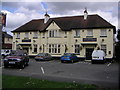
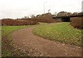
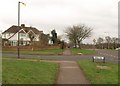
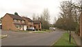

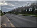
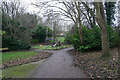
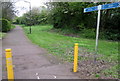
15 photos from this area
Area Information
Key information about the MK13 7AW including its size, population, and administrative classification.
- Area Type
- Postcode
- Area Size
- 9931 m²
- Population
- 1805
- Population Density
- 4460 people/km²
House Prices in MK13 7AW
20
Properties
£166,321
Average Sold Price
£59,000
Lowest Price
£270,000
Highest Price
Showing 20 properties
| Address | Type | Beds | Baths | Last Sale Price | Last Sale Date | |
|---|---|---|---|---|---|---|
| 97 Bradwell Road, Bradville, Milton Keynes, MK13 7AW | Terraced | 3 | 1 | £270,000 | Sep 2024 | |
| 115 Bradwell Road, Bradville, Milton Keynes, MK13 7AW | Semi-detached | 3 | 1 | £250,000 | Feb 2021 | |
| 121 Bradwell Road, Bradville, Milton Keynes, MK13 7AW | Semi-detached | 3 | 2 | £252,000 | Mar 2020 | |
| 113 Bradwell Road, Bradville, Milton Keynes, MK13 7AW | Semi-detached | 3 | 1 | £215,000 | Jul 2019 | |
| 125 Bradwell Road, Bradville, Milton Keynes, MK13 7AW | Semi-detached | 3 | 1 | £260,000 | Oct 2018 | |
| 99 Bradwell Road, Bradville, Milton Keynes, MK13 7AW | Terraced | 3 | 1 | £203,000 | Oct 2017 | |
| 105A Bradwell Road, Bradville, Milton Keynes, MK13 7AW | house | - | - | £120,000 | Apr 2016 | |
| 127 Bradwell Road, Bradville, Milton Keynes, MK13 7AW | house | 3 | - | £180,000 | Nov 2011 | |
| 111 Bradwell Road, Bradville, Milton Keynes, MK13 7AW | house | - | - | £152,500 | Mar 2007 | |
| 103A Bradwell Road, Bradville, Milton Keynes, MK13 7AW | Terraced | 3 | 1 | £85,500 | Oct 2006 |
Page 1 of 2
Energy Efficiency in MK13 7AW
Amenities
Schools
| Rank | School | Type | Entry gender | Ages |
|---|
Explore more schools in this area
Go to Schools tabDemographics
Household Size
Family (3-5 people)
most common
Accommodation Type
Houses
most common
Tenure
66
majority
Ethnic Group
White
most common
Religion
N/A
most common
Household Composition
N/A
most common
Age
47
median
Adults (30-64 years)
most common
Household Deprivation
N/A
with no deprivation
NS-SEC
27
in Lower managerial occupations
Explore more demographic insights in this area
Go to Demographics tabPlanning
Planning Constraints
- Flood RiskPremium
- Ramsar Wetland SitesPremium
- Area of Outstanding Natural BeautyPremium
- Protected Nature ReservePremium
- Protected WoodlandPremium