Area Overview for MK13 0ER
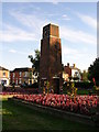
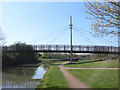
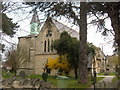
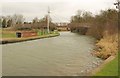
Photos of MK13 0ER


Area Information
MK13 0ER is a small residential cluster in England, spanning just 2.7 hectares and home to 2,458 people. Its compact size means it’s a tight-knit community with a high population density of 2,062 people per square kilometre. This area is characterised by its focus on local living, with residents often relying on nearby amenities for daily needs. The presence of multiple primary schools and rail stations within practical reach suggests a balance between convenience and accessibility. While the area is not expansive, its proximity to Milton Keynes and surrounding towns offers broader connectivity. The demographic profile—centred on adults aged 30–64—hints at a community of professionals and families, many of whom may be drawn to the area’s mix of residential tranquillity and commuter ease. Living here means navigating a small, densely populated space where local shops, schools, and transport links are within walking or short driving distance. The area’s limitations in size are offset by its strategic position, making it a viable choice for those prioritising proximity to essential services over sprawling suburban landscapes.
- Area Type
- Postcode
- Area Size
- 2.7 hectares
- Population
- 2458
- Population Density
- 2062 people/km²
The property market in MK13 0ER is defined by its small scale and focus on owner-occupied homes. With 45% of properties owned by residents, the area leans towards a mix of long-term homeowners and renters, though the exact proportion of rental properties is not specified. The accommodation type is predominantly houses, which is unusual for a small postcode area and may indicate a preference for single-family living. This suggests that the housing stock is limited in quantity but potentially more spacious than in high-density urban areas. Buyers should consider the area’s size, as its 2.7-hectare footprint offers little room for expansion. Those seeking homes in MK13 0ER may need to look beyond the immediate postcode to nearby regions for more options. The market is likely to cater to those prioritising proximity to schools, rail links, and local amenities over the availability of larger properties.
House Prices in MK13 0ER
No properties found in this postcode.
Energy Efficiency in MK13 0ER
The lifestyle in MK13 0ER is shaped by its proximity to local retail and transport hubs. Nearby amenities include Co-op Bradwell, Farmfoods Wolverton, and Asda Wolverton, offering essential shopping and grocery needs within walking or short driving distance. The rail stations provide access to broader leisure and employment opportunities in Milton Keynes and surrounding areas. While the area itself is compact, its strategic location ensures residents can reach larger towns for dining, entertainment, and cultural activities. The presence of multiple primary schools and rail links suggests a community focused on family life and daily convenience. However, the lack of parks or leisure facilities within the postcode means residents may need to venture beyond MK13 0ER for outdoor recreation. The area’s character is defined by its practicality, with local shops and transport links forming the backbone of daily life.
Amenities
Schools
MK13 0ER is served by three primary schools: New Bradwell School, Bushfield School, and New Bradwell Primary School. Both Bushfield and New Bradwell Primary School hold Ofsted ratings of ‘good’, indicating a satisfactory standard of education. These schools provide a range of options for families, though the absence of secondary schools in the area means students may need to commute to nearby towns for further education. The presence of multiple primary schools suggests a focus on early education, which is beneficial for families with young children. However, the lack of data on school capacity or catchment areas means prospective buyers should verify whether their preferred school is accessible. The quality of primary education in the area appears to be a key draw for families, though the overall educational landscape remains limited to primary-level provision.
| Rank | School | Type | Entry gender | Ages |
|---|
Explore more schools in this area
Go to Schools tabDemographics
MK13 0ER’s population is predominantly adults aged 30–64, with a median age of 47. This suggests a community of established professionals and families, rather than a younger or elderly demographic. Home ownership sits at 45%, indicating a mix of owner-occupied properties and rental units. The accommodation type is largely houses, which aligns with the area’s small scale and residential focus. The predominant ethnic group is White, though no specific data on diversity or deprivation is provided. The high population density—2,062 people per square kilometre—means the area is compact, with limited space for expansion. This density may influence the character of daily life, fostering a sense of familiarity among residents while potentially limiting privacy. For buyers, the demographic profile suggests a stable, mature community with a focus on local amenities and services, though the area’s size may restrict opportunities for larger family homes or new developments.
Household Size
Accommodation Type
Tenure
Ethnic Group
Religion
Household Composition
Age
Household Deprivation
NS-SEC
Explore more demographic insights in this area
Go to Demographics tabPlanning
Planning Constraints
- Flood RiskPremium
- Ramsar Wetland SitesPremium
- Area of Outstanding Natural BeautyPremium
- Protected Nature ReservePremium
- Protected WoodlandPremium