Area Overview for MK12 6HB
Photos of MK12 6HB
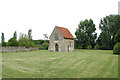
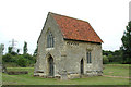
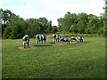

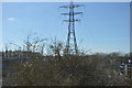


36 photos from this area
Area Information
Key information about the MK12 6HB including its size, population, and administrative classification.
- Area Type
- Postcode
- Area Size
- 3.1 hectares
- Population
- 1252
- Population Density
- 2971 people/km²
House Prices in MK12 6HB
44
Properties
£165,685
Average Sold Price
£18,900
Lowest Price
£345,000
Highest Price
Showing 44 properties
| Address | Type | Beds | Baths | Last Sale Price | Last Sale Date | |
|---|---|---|---|---|---|---|
| 27 Lingfield, Stacey Bushes, Milton Keynes, MK12 6HB | Semi-detached | 3 | 1 | £192,000 | May 2023 | |
| 19 Lingfield, Stacey Bushes, Milton Keynes, MK12 6HB | Detached | 3 | 2 | £310,000 | Apr 2023 | |
| 30 Lingfield, Stacey Bushes, Milton Keynes, MK12 6HB | house | - | - | £345,000 | Mar 2023 | |
| 18 Lingfield, Stacey Bushes, Milton Keynes, MK12 6HB | Detached | 4 | 1 | £265,000 | Mar 2020 | |
| 23 Lingfield, Stacey Bushes, Milton Keynes, MK12 6HB | house | 3 | 2 | £150,000 | Jan 2020 | |
| 21 Lingfield, Stacey Bushes, Milton Keynes, MK12 6HB | house | 3 | 1 | £265,000 | Nov 2018 | |
| 5 Lingfield, Stacey Bushes, Milton Keynes, MK12 6HB | Semi-detached | 3 | 2 | £227,000 | Aug 2017 | |
| 10 Lingfield, Stacey Bushes, Milton Keynes, MK12 6HB | house | - | - | £160,000 | Jul 2016 | |
| 9 Lingfield, Stacey Bushes, Milton Keynes, MK12 6HB | Semi-detached | 3 | 1 | £190,000 | Feb 2016 | |
| 11 Lingfield, Stacey Bushes, Milton Keynes, MK12 6HB | Terraced | - | - | £140,000 | Feb 2015 |
Page 1 of 5
Energy Efficiency in MK12 6HB
Amenities
Schools
| Rank | School | Type | Entry gender | Ages |
|---|
Explore more schools in this area
Go to Schools tabDemographics
Household Size
Family (3-5 people)
most common
Accommodation Type
Houses
most common
Tenure
40
majority
Ethnic Group
White
most common
Religion
N/A
most common
Household Composition
N/A
most common
Age
47
median
Adults (30-64 years)
most common
Household Deprivation
N/A
with no deprivation
NS-SEC
18
in Lower managerial occupations
Explore more demographic insights in this area
Go to Demographics tabPlanning
Planning Constraints
- Flood RiskPremium
- Ramsar Wetland SitesPremium
- Area of Outstanding Natural BeautyPremium
- Protected Nature ReservePremium
- Protected WoodlandPremium