Area Overview for MK11 4DR
Photos of MK11 4DR
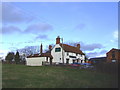
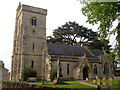

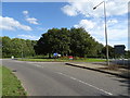


19 photos from this area
Area Information
Key information about the MK11 4DR including its size, population, and administrative classification.
- Area Type
- Postcode
- Area Size
- 2.3 hectares
- Population
- 1585
- Population Density
- 3613 people/km²
House Prices in MK11 4DR
70
Properties
£410,145
Average Sold Price
£160,000
Lowest Price
£769,995
Highest Price
Showing 70 properties
| Address | Type | Beds | Baths | Last Sale Price | Last Sale Date | |
|---|---|---|---|---|---|---|
| 132 Cicero Crescent, Fairfields, Milton Keynes, MK11 4DR | Maisonette | 2 | 1 | £242,000 | Feb 2024 | |
| 183 Cicero Crescent, Fairfields, Milton Keynes, MK11 4DR | Semi-detached | 4 | 2 | £405,000 | Jul 2023 | |
| 169 Cicero Crescent, Fairfields, Milton Keynes, MK11 4DR | house | - | - | £572,995 | Apr 2022 | |
| 187 Cicero Crescent, Fairfields, Milton Keynes, MK11 4DR | house | - | - | £395,995 | Dec 2021 | |
| 185 Cicero Crescent, Fairfields, Milton Keynes, MK11 4DR | house | - | - | £390,995 | Dec 2021 | |
| 124 Cicero Crescent, Fairfields, Milton Keynes, MK11 4DR | house | - | - | £160,000 | Aug 2021 | |
| 177 Cicero Crescent, Fairfields, Milton Keynes, MK11 4DR | house | - | - | £389,995 | Jun 2021 | |
| 159 Cicero Crescent, Fairfields, Milton Keynes, MK11 4DR | Semi-detached | 3 | 3 | £387,995 | Jun 2021 | |
| 174 Cicero Crescent, Fairfields, Milton Keynes, MK11 4DR | house | - | - | £361,495 | May 2021 | |
| 176 Cicero Crescent, Fairfields, Milton Keynes, MK11 4DR | house | - | - | £361,495 | May 2021 |
Page 1 of 7
Energy Efficiency in MK11 4DR
Amenities
Schools
| Rank | School | Type | Entry gender | Ages |
|---|
Explore more schools in this area
Go to Schools tabDemographics
Household Size
Family (3-5 people)
most common
Accommodation Type
Houses
most common
Tenure
89
majority
Ethnic Group
White
most common
Religion
N/A
most common
Household Composition
N/A
most common
Age
47
median
Adults (30-64 years)
most common
Household Deprivation
N/A
with no deprivation
NS-SEC
58
in Lower managerial occupations
Explore more demographic insights in this area
Go to Demographics tabPlanning
Planning Constraints
- Flood RiskPremium
- Ramsar Wetland SitesPremium
- Area of Outstanding Natural BeautyPremium
- Protected Nature ReservePremium
- Protected WoodlandPremium