Area Overview for MK11 4AP
Photos of MK11 4AP


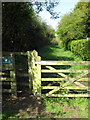
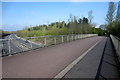


16 photos from this area
Area Information
Key information about the MK11 4AP including its size, population, and administrative classification.
- Area Type
- Postcode
- Area Size
- 7983 m²
- Population
- 1585
- Population Density
- 3613 people/km²
House Prices in MK11 4AP
15
Properties
£415,396
Average Sold Price
£267,995
Lowest Price
£662,000
Highest Price
Showing 15 properties
| Address | Type | Beds | Baths | Last Sale Price | Last Sale Date | |
|---|---|---|---|---|---|---|
| 4 Aquila Gardens, Fairfields, Milton Keynes, MK11 4AP | house | - | - | £525,000 | Jan 2025 | |
| 13 Aquila Gardens, Fairfields, Milton Keynes, MK11 4AP | Detached | 5 | 5 | £662,000 | May 2024 | |
| 14 Aquila Gardens, Fairfields, Milton Keynes, MK11 4AP | house | - | - | £410,000 | May 2020 | |
| 2 Aquila Gardens, Fairfields, Milton Keynes, MK11 4AP | house | 4 | 2 | £439,995 | Mar 2018 | |
| 8 Aquila Gardens, Fairfields, Milton Keynes, MK11 4AP | Semi-detached | 4 | 4 | £429,995 | Dec 2017 | |
| 6 Aquila Gardens, Fairfields, Milton Keynes, MK11 4AP | Maisonette | 2 | 2 | £267,995 | Dec 2017 | |
| 10 Aquila Gardens, Fairfields, Milton Keynes, MK11 4AP | house | - | - | £420,995 | May 2017 | |
| 16 Aquila Gardens, Fairfields, Milton Keynes, MK11 4AP | house | - | - | £489,995 | Mar 2017 | |
| 12 Aquila Gardens, Fairfields, Milton Keynes, MK11 4AP | house | - | - | £410,995 | Mar 2017 | |
| 3 Aquila Gardens, Fairfields, Milton Keynes, MK11 4AP | house | - | - | £351,995 | Jun 2016 |
Page 1 of 2
Energy Efficiency in MK11 4AP
Amenities
Schools
| Rank | School | Type | Entry gender | Ages |
|---|
Explore more schools in this area
Go to Schools tabDemographics
Household Size
Family (3-5 people)
most common
Accommodation Type
Houses
most common
Tenure
89
majority
Ethnic Group
White
most common
Religion
N/A
most common
Household Composition
N/A
most common
Age
47
median
Adults (30-64 years)
most common
Household Deprivation
N/A
with no deprivation
NS-SEC
58
in Lower managerial occupations
Explore more demographic insights in this area
Go to Demographics tabPlanning
Planning Constraints
- Flood RiskPremium
- Ramsar Wetland SitesPremium
- Area of Outstanding Natural BeautyPremium
- Protected Nature ReservePremium
- Protected WoodlandPremium