Area Overview for MK11 1HZ
Photos of MK11 1HZ
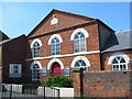
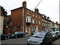
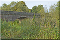
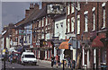
100 photos from this area
Area Information
Key information about the MK11 1HZ including its size, population, and administrative classification.
- Area Type
- Postcode
- Area Size
- 4.2 hectares
- Population
- 1789
- Population Density
- 2474 people/km²
House Prices in MK11 1HZ
36
Properties
£263,082
Average Sold Price
£25,000
Lowest Price
£997,000
Highest Price
Showing 36 properties
| Address | Type | Beds | Baths | Last Sale Price | Last Sale Date | |
|---|---|---|---|---|---|---|
| 2 Horn Lane, Stony Stratford, MK11 1HZ | Detached | 5 | 3 | £997,000 | Mar 2025 | |
| 8 Horn Lane, Stony Stratford, MK11 1HZ | Terraced | 2 | 2 | £310,000 | Jul 2024 | |
| 31 Horn Lane, Stony Stratford, MK11 1HZ | Terraced | 2 | 1 | £312,500 | Nov 2022 | |
| 9 Horn Lane, Stony Stratford, MK11 1HZ | house | - | - | £375,000 | Oct 2022 | |
| 18 Horn Lane, Stony Stratford, MK11 1HZ | Terraced | 5 | - | £510,000 | Apr 2021 | |
| 25 Horn Lane, Stony Stratford, MK11 1HZ | Terraced | 3 | 2 | £340,000 | Sep 2019 | |
| 11 Horn Lane, Stony Stratford, MK11 1HZ | Semi-detached | 2 | 2 | £319,000 | Apr 2019 | |
| 21 Horn Lane, Stony Stratford, MK11 1HZ | Terraced | 3 | 1 | £352,000 | Mar 2019 | |
| 13 Horn Lane, Stony Stratford, MK11 1HZ | Flat | 3 | 2 | £275,000 | Jan 2018 | |
| 27 Horn Lane, Stony Stratford, MK11 1HZ | Terraced | 3 | 1 | £284,995 | Sep 2015 |
Page 1 of 4
Energy Efficiency in MK11 1HZ
Amenities
Schools
| Rank | School | Type | Entry gender | Ages |
|---|
Explore more schools in this area
Go to Schools tabDemographics
Household Size
One person
most common
Accommodation Type
Houses
most common
Tenure
61
majority
Ethnic Group
White
most common
Religion
N/A
most common
Household Composition
N/A
most common
Age
47
median
Adults (30-64 years)
most common
Household Deprivation
N/A
with no deprivation
NS-SEC
46
in Lower managerial occupations
Explore more demographic insights in this area
Go to Demographics tabPlanning
Planning Constraints
- Flood RiskPremium
- Ramsar Wetland SitesPremium
- Area of Outstanding Natural BeautyPremium
- Protected Nature ReservePremium
- Protected WoodlandPremium