Area Overview for MK11 1HP
Photos of MK11 1HP
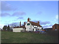
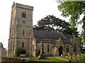
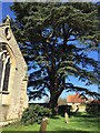
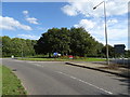
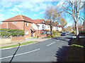
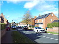
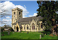
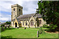
19 photos from this area
Area Information
Key information about the MK11 1HP including its size, population, and administrative classification.
- Area Type
- Postcode
- Area Size
- 7.1 hectares
- Population
- 1562
- Population Density
- 3477 people/km²
House Prices in MK11 1HP
47
Properties
£306,771
Average Sold Price
£77,500
Lowest Price
£620,000
Highest Price
Showing 47 properties
| Address | Type | Beds | Baths | Last Sale Price | Last Sale Date | |
|---|---|---|---|---|---|---|
| 39 Latimer, Stony Stratford, MK11 1HP | house | - | - | £455,000 | Jun 2024 | |
| 23 Latimer, Stony Stratford, MK11 1HP | house | 4 | 2 | £515,000 | Oct 2022 | |
| 1 Latimer, Stony Stratford, MK11 1HP | Bungalow | - | - | £620,000 | Mar 2022 | |
| 43 Latimer, Stony Stratford, MK11 1HP | house | 4 | 2 | £450,000 | Mar 2022 | |
| 9 Latimer, Stony Stratford, MK11 1HP | Detached | 4 | 2 | £515,000 | Oct 2021 | |
| 29 Latimer, Stony Stratford, MK11 1HP | house | - | - | £405,000 | Jan 2021 | |
| 51 Latimer, Stony Stratford, MK11 1HP | Detached | 4 | - | £400,000 | Jul 2018 | |
| 21A Latimer, Stony Stratford, MK11 1HP | house | - | - | £450,000 | Apr 2017 | |
| 47 Latimer, Stony Stratford, MK11 1HP | house | - | - | £345,000 | Mar 2016 | |
| 27 Latimer, Stony Stratford, MK11 1HP | Detached | 4 | 1 | £290,000 | Apr 2015 |
Page 1 of 5
Energy Efficiency in MK11 1HP
Amenities
Schools
| Rank | School | Type | Entry gender | Ages |
|---|
Explore more schools in this area
Go to Schools tabDemographics
Household Size
Two person
most common
Accommodation Type
Houses
most common
Tenure
77
majority
Ethnic Group
White
most common
Religion
N/A
most common
Household Composition
N/A
most common
Age
47
median
Adults (30-64 years)
most common
Household Deprivation
N/A
with no deprivation
NS-SEC
34
in Lower managerial occupations
Explore more demographic insights in this area
Go to Demographics tabPlanning
Planning Constraints
- Flood RiskPremium
- Ramsar Wetland SitesPremium
- Area of Outstanding Natural BeautyPremium
- Protected Nature ReservePremium
- Protected WoodlandPremium