Area Overview for MK11 1AT
Photos of MK11 1AT
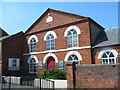
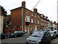
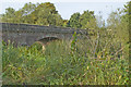
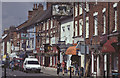
100 photos from this area
Area Information
Key information about the MK11 1AT including its size, population, and administrative classification.
- Area Type
- Postcode
- Area Size
- 3.3 hectares
- Population
- 1789
- Population Density
- 2474 people/km²
House Prices in MK11 1AT
40
Properties
£410,184
Average Sold Price
£69,500
Lowest Price
£1,190,000
Highest Price
Showing 40 properties
| Address | Type | Beds | Baths | Last Sale Price | Last Sale Date | |
|---|---|---|---|---|---|---|
| 131 High Street, Stony Stratford, MK11 1AT | Semi-detached | 6 | 3 | £965,000 | Dec 2025 | |
| 163 High Street, Stony Stratford, MK11 1AT | Terraced | 2 | 1 | £247,000 | Jul 2025 | |
| 167 High Street, Stony Stratford, MK11 1AT | Terraced | 2 | 1 | £320,000 | Mar 2025 | |
| 121 High Street, Stony Stratford, MK11 1AT | Terraced | 2 | 2 | £375,000 | Mar 2025 | |
| 129 High Street, Stony Stratford, MK11 1AT | Bungalow | 4 | 4 | £1,190,000 | Aug 2023 | |
| 165 High Street, Stony Stratford, MK11 1AT | house | - | - | £270,000 | Mar 2022 | |
| 119 High Street, Stony Stratford, MK11 1AT | Terraced | 5 | - | £650,000 | Jan 2022 | |
| 115 High Street, Stony Stratford, MK11 1AT | Terraced | 3 | 1 | £360,000 | Oct 2021 | |
| 91 High Street, Stony Stratford, MK11 1AT | Terraced | - | - | £550,000 | Jun 2021 | |
| 107 High Street, Stony Stratford, MK11 1AT | Detached | - | - | £950,000 | Mar 2021 |
Page 1 of 4
Energy Efficiency in MK11 1AT
Amenities
Schools
| Rank | School | Type | Entry gender | Ages |
|---|
Explore more schools in this area
Go to Schools tabDemographics
Household Size
One person
most common
Accommodation Type
Houses
most common
Tenure
61
majority
Ethnic Group
White
most common
Religion
N/A
most common
Household Composition
N/A
most common
Age
47
median
Adults (30-64 years)
most common
Household Deprivation
N/A
with no deprivation
NS-SEC
46
in Lower managerial occupations
Explore more demographic insights in this area
Go to Demographics tabPlanning
Planning Constraints
- Flood RiskPremium
- Ramsar Wetland SitesPremium
- Area of Outstanding Natural BeautyPremium
- Protected Nature ReservePremium
- Protected WoodlandPremium