Area Overview for MK10 9RP
Photos of MK10 9RP


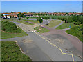

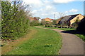
17 photos from this area
Area Information
Key information about the MK10 9RP including its size, population, and administrative classification.
- Area Type
- Postcode
- Area Size
- 3.4 hectares
- Population
- 1796
- Population Density
- 3689 people/km²
House Prices in MK10 9RP
67
Properties
£186,153
Average Sold Price
£51,000
Lowest Price
£403,000
Highest Price
Showing 67 properties
| Address | Type | Beds | Baths | Last Sale Price | Last Sale Date | |
|---|---|---|---|---|---|---|
| 85 Tyhurst, Middleton, Milton Keynes, MK10 9RP | Flat | 2 | 1 | £96,000 | Aug 2025 | |
| 77 Tyhurst, Middleton, Milton Keynes, MK10 9RP | Flat | - | - | £215,000 | Jul 2025 | |
| 31 Tyhurst, Middleton, Milton Keynes, MK10 9RP | Flat | - | - | £88,000 | Jan 2025 | |
| 65 Tyhurst, Middleton, Milton Keynes, MK10 9RP | Terraced | 3 | 2 | £380,000 | Jan 2024 | |
| 103 Tyhurst, Middleton, Milton Keynes, MK10 9RP | Flat | 2 | 2 | £222,500 | Nov 2023 | |
| 81 Tyhurst, Middleton, Milton Keynes, MK10 9RP | Flat | - | - | £120,000 | Jul 2023 | |
| 23 Tyhurst, Middleton, Milton Keynes, MK10 9RP | Semi-detached | 3 | 2 | £395,000 | Jun 2023 | |
| 87 Tyhurst, Middleton, Milton Keynes, MK10 9RP | Flat | 4 | 2 | £102,000 | Aug 2022 | |
| 39 Tyhurst, Middleton, Milton Keynes, MK10 9RP | Flat | 2 | 1 | £96,000 | Mar 2022 | |
| 105 Tyhurst, Middleton, Milton Keynes, MK10 9RP | Flat | - | - | £200,000 | Mar 2022 |
Page 1 of 7
Energy Efficiency in MK10 9RP
Amenities
Schools
| Rank | School | Type | Entry gender | Ages |
|---|
Explore more schools in this area
Go to Schools tabDemographics
Household Size
Family (3-5 people)
most common
Accommodation Type
Houses
most common
Tenure
76
majority
Ethnic Group
White
most common
Religion
N/A
most common
Household Composition
N/A
most common
Age
47
median
Adults (30-64 years)
most common
Household Deprivation
N/A
with no deprivation
NS-SEC
49
in Lower managerial occupations
Explore more demographic insights in this area
Go to Demographics tabPlanning
Planning Constraints
- Flood RiskPremium
- Ramsar Wetland SitesPremium
- Area of Outstanding Natural BeautyPremium
- Protected Nature ReservePremium
- Protected WoodlandPremium