Area Overview for MK10 9NH
Photos of MK10 9NH


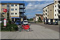


24 photos from this area
Area Information
Key information about the MK10 9NH including its size, population, and administrative classification.
- Area Type
- Postcode
- Area Size
- 3624 m²
- Population
- 1759
- Population Density
- 5130 people/km²
House Prices in MK10 9NH
23
Properties
£141,331
Average Sold Price
£75,000
Lowest Price
£218,000
Highest Price
Showing 23 properties
| Address | Type | Beds | Baths | Last Sale Price | Last Sale Date | |
|---|---|---|---|---|---|---|
| 39 Tanfield Lane, Broughton, Milton Keynes, MK10 9NH | Flat | 2 | 2 | £218,000 | Oct 2025 | |
| 3 Tanfield Lane, Broughton, Milton Keynes, MK10 9NH | Flat | - | - | £75,000 | Jun 2025 | |
| 15 Tanfield Lane, Broughton, Milton Keynes, MK10 9NH | Flat | - | - | £196,000 | Dec 2024 | |
| 45 Tanfield Lane, Broughton, Milton Keynes, MK10 9NH | Flat | - | - | £218,000 | Jun 2023 | |
| 27 Tanfield Lane, Broughton, Milton Keynes, MK10 9NH | Flat | - | - | £140,000 | Mar 2023 | |
| 25 Tanfield Lane, Broughton, Milton Keynes, MK10 9NH | Flat | 2 | 1 | £205,000 | Sep 2022 | |
| 11 Tanfield Lane, Broughton, Milton Keynes, MK10 9NH | Flat | - | - | £100,000 | Dec 2021 | |
| 35 Tanfield Lane, Broughton, Milton Keynes, MK10 9NH | Flat | - | - | £147,000 | Feb 2021 | |
| 21 Tanfield Lane, Broughton, Milton Keynes, MK10 9NH | Flat | 2 | 1 | £175,000 | Feb 2020 | |
| 23 Tanfield Lane, Broughton, Milton Keynes, MK10 9NH | Flat | - | - | £141,000 | Sep 2019 |
Page 1 of 3
Energy Efficiency in MK10 9NH
Amenities
Schools
| Rank | School | Type | Entry gender | Ages |
|---|
Explore more schools in this area
Go to Schools tabDemographics
Household Size
Family (3-5 people)
most common
Accommodation Type
Flats
most common
Tenure
51
majority
Ethnic Group
White
most common
Religion
N/A
most common
Household Composition
N/A
most common
Age
47
median
Adults (30-64 years)
most common
Household Deprivation
N/A
with no deprivation
NS-SEC
35
in Lower managerial occupations
Explore more demographic insights in this area
Go to Demographics tabPlanning
Planning Constraints
- Flood RiskPremium
- Ramsar Wetland SitesPremium
- Area of Outstanding Natural BeautyPremium
- Protected Nature ReservePremium
- Protected WoodlandPremium