Area Overview for MK10 7GR
Photos of MK10 7GR


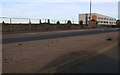
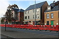
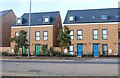
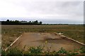
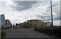
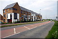
20 photos from this area
Area Information
Key information about the MK10 7GR including its size, population, and administrative classification.
- Area Type
- Postcode
- Area Size
- 6022 m²
- Population
- 1895
- Population Density
- 6941 people/km²
House Prices in MK10 7GR
21
Properties
£206,657
Average Sold Price
£150,000
Lowest Price
£425,000
Highest Price
Showing 21 properties
| Address | Type | Beds | Baths | Last Sale Price | Last Sale Date | |
|---|---|---|---|---|---|---|
| 6 Doxford Heath, Brooklands, Milton Keynes, MK10 7GR | house | 1 | 1 | £235,000 | Jul 2025 | |
| 18 Doxford Heath, Brooklands, Milton Keynes, MK10 7GR | Semi-detached | 3 | 2 | £425,000 | Jan 2025 | |
| 10 Doxford Heath, Brooklands, Milton Keynes, MK10 7GR | Semi-detached | 3 | 3 | £390,000 | Jul 2023 | |
| 21 Doxford Heath, Brooklands, Milton Keynes, MK10 7GR | house | - | - | £260,000 | Nov 2022 | |
| 12 Doxford Heath, Brooklands, Milton Keynes, MK10 7GR | Retail | 1 | 1 | £240,000 | Feb 2022 | |
| 15 Doxford Heath, Brooklands, Milton Keynes, MK10 7GR | Semi-detached | 1 | 1 | £193,000 | Nov 2019 | |
| 23 Doxford Heath, Brooklands, Milton Keynes, MK10 7GR | Detached | 1 | 1 | £165,000 | Oct 2015 | |
| 19 Doxford Heath, Brooklands, Milton Keynes, MK10 7GR | Semi-detached | 1 | 1 | £165,000 | Sep 2015 | |
| 17 Doxford Heath, Brooklands, Milton Keynes, MK10 7GR | coachHouse | 1 | 1 | £165,000 | Sep 2015 | |
| 13 Doxford Heath, Brooklands, Milton Keynes, MK10 7GR | house | 1 | 1 | £169,000 | Sep 2015 |
Page 1 of 3
Energy Efficiency in MK10 7GR
Amenities
Schools
| Rank | School | Type | Entry gender | Ages |
|---|
Explore more schools in this area
Go to Schools tabDemographics
Household Size
Family (3-5 people)
most common
Accommodation Type
Houses
most common
Tenure
57
majority
Ethnic Group
White
most common
Religion
N/A
most common
Household Composition
N/A
most common
Age
47
median
Adults (30-64 years)
most common
Household Deprivation
N/A
with no deprivation
NS-SEC
44
in Lower managerial occupations
Explore more demographic insights in this area
Go to Demographics tabPlanning
Planning Constraints
- Flood RiskPremium
- Ramsar Wetland SitesPremium
- Area of Outstanding Natural BeautyPremium
- Protected Nature ReservePremium
- Protected WoodlandPremium