Area Overview for MK10 7FU
Photos of MK10 7FU

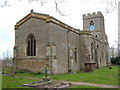
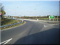
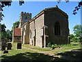
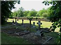
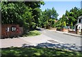
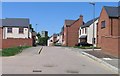


57 photos from this area
Area Information
Key information about the MK10 7FU including its size, population, and administrative classification.
- Area Type
- Postcode
- Area Size
- 4917 m²
- Population
- 1851
- Population Density
- 4095 people/km²
House Prices in MK10 7FU
18
Properties
£287,382
Average Sold Price
£162,000
Lowest Price
£422,995
Highest Price
Showing 18 properties
| Address | Type | Beds | Baths | Last Sale Price | Last Sale Date | |
|---|---|---|---|---|---|---|
| 18 Victory Avenue, Brooklands, Milton Keynes, MK10 7FU | Semi-detached | 3 | 3 | £370,000 | Nov 2023 | |
| 8 Victory Avenue, Brooklands, Milton Keynes, MK10 7FU | Terraced | 3 | 1 | £295,000 | Jan 2021 | |
| 2 Victory Avenue, Brooklands, Milton Keynes, MK10 7FU | Detached | 3 | 2 | £325,000 | Nov 2019 | |
| 4 Victory Avenue, Brooklands, Milton Keynes, MK10 7FU | Terraced | 3 | 2 | £308,000 | Jul 2017 | |
| 11 Victory Avenue, Brooklands, Milton Keynes, MK10 7FU | house | - | - | £162,000 | Apr 2016 | |
| 16 Victory Avenue, Brooklands, Milton Keynes, MK10 7FU | Semi-detached | 3 | 2 | £247,995 | Dec 2015 | |
| 10 Victory Avenue, Brooklands, Milton Keynes, MK10 7FU | house | - | - | £243,995 | Dec 2015 | |
| 6 Victory Avenue, Brooklands, Milton Keynes, MK10 7FU | house | - | - | £240,495 | Dec 2015 | |
| 14 Victory Avenue, Brooklands, Milton Keynes, MK10 7FU | house | - | - | £248,495 | Dec 2015 | |
| 15 Victory Avenue, Brooklands, Milton Keynes, MK10 7FU | house | - | - | £315,995 | Nov 2015 |
Page 1 of 2
Energy Efficiency in MK10 7FU
Amenities
Schools
| Rank | School | Type | Entry gender | Ages |
|---|
Explore more schools in this area
Go to Schools tabDemographics
Household Size
Family (3-5 people)
most common
Accommodation Type
Houses
most common
Tenure
81
majority
Ethnic Group
White
most common
Religion
N/A
most common
Household Composition
N/A
most common
Age
47
median
Adults (30-64 years)
most common
Household Deprivation
N/A
with no deprivation
NS-SEC
55
in Lower managerial occupations
Explore more demographic insights in this area
Go to Demographics tabPlanning
Planning Constraints
- Flood RiskPremium
- Ramsar Wetland SitesPremium
- Area of Outstanding Natural BeautyPremium
- Protected Nature ReservePremium
- Protected WoodlandPremium