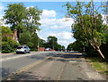
Area Overview for MK1 1DQ
Photos of MK1 1DQ


Area Information
MK1 1DQ is a small, compact residential area in England, covering just 1.2 hectares and home to 1,961 residents. Its high population density of 873 people per square kilometre reflects a tightly knit community, where daily life is shaped by proximity to local amenities and transport links. The area is defined by its modest size, which means residents are likely to know their neighbours and have easy access to nearby services. With a median age of 47 and a strong presence of adults aged 30–64, the area is well-suited for families and professionals seeking a balanced lifestyle. While it lacks the sprawling infrastructure of larger towns, its strategic location near rail stations and retail hubs offers practical convenience. The absence of major planning constraints, such as protected nature reserves or AONB designations, suggests a straightforward approach to development. However, the area’s small footprint means buyers should consider its limited scope for expansion or change. For those prioritising community, accessibility, and simplicity, MK1 1DQ presents a distinct proposition.
- Area Type
- Postcode
- Area Size
- 1.2 hectares
- Population
- 1961
- Population Density
- 873 people/km²
MK1 1DQ’s property market is characterised by a 41% home ownership rate, with houses forming the majority of accommodation types. This indicates a community where many residents own their homes, though the remaining 59% are likely to be in the rental market. The predominance of houses suggests a focus on family homes, which may appeal to buyers seeking space and stability. However, the area’s small size—just 1.2 hectares—means the housing stock is limited, and buyers should consider proximity to surrounding areas for more options. The mix of ownership and rental properties could create a competitive market, particularly for first-time buyers or those seeking to move into the area. Given the lack of planning constraints, development may be more flexible, but the compact nature of MK1 1DQ means any growth is likely to be incremental. For those prioritising a house in a close-knit community, this area offers a niche opportunity.
House Prices in MK1 1DQ
No properties found in this postcode.
Energy Efficiency in MK1 1DQ
Living in MK1 1DQ offers a blend of practicality and accessibility, with nearby amenities that cater to everyday needs. The area’s retail options include five notable venues: Aldi Bletchley, Tesco Milton, and Asda Milton, providing a range of grocery and household shopping choices. These stores are likely within walking distance or a short drive, making errands efficient. The presence of five rail stations—Fenny Stratford, Bletchley, and Bow Brickhill—enhances mobility, offering connections to regional and national routes. While the data does not specify parks or leisure facilities, the proximity to rail and retail suggests a focus on convenience over expansive recreational spaces. The compact nature of the area means residents may rely on nearby towns for more extensive amenities, but the existing infrastructure supports a lifestyle that balances local needs with broader connectivity.
Amenities
Schools
Residents of MK1 1DQ have access to Simpson School, a primary school, and Charles Warren Academy, an academy with a Good Ofsted rating. The presence of both a primary school and an academy suggests a comprehensive educational offering for families, covering early years through secondary education. Simpson School provides foundational learning for younger children, while Charles Warren Academy offers a broader curriculum and potentially higher academic standards, given its Ofsted rating. The mix of school types may appeal to parents seeking a range of educational options, though the data does not specify enrollment numbers or catchment areas. For families prioritising quality education, the combination of a primary school and a rated academy offers a practical advantage. However, buyers should verify whether these schools are within walking distance or require additional commuting.
| Rank | School | Type | Entry gender | Ages |
|---|
Explore more schools in this area
Go to Schools tabDemographics
The population of MK1 1DQ skews towards adults aged 30–64, with a median age of 47. This suggests a mature, stable community with a focus on long-term residency. Home ownership accounts for 41% of households, while the remaining 59% are likely renters, indicating a mix of owner-occupied and rental properties. The predominant accommodation type is houses, which aligns with the area’s compact size and residential character. The predominant ethnic group is White, with no specific data on other demographics provided. The high proportion of adults in the 30–64 age range implies a population that may be raising children, working in local or regional industries, or nearing retirement. The absence of detailed diversity statistics means the community’s cultural composition remains undefined in the data. For buyers, this profile suggests a focus on family-oriented living, with housing stock tailored to settled households rather than transient populations.
Household Size
Accommodation Type
Tenure
Ethnic Group
Religion
Household Composition
Age
Household Deprivation
NS-SEC
Explore more demographic insights in this area
Go to Demographics tabPlanning
Planning Constraints
- Flood RiskPremium
- Ramsar Wetland SitesPremium
- Area of Outstanding Natural BeautyPremium
- Protected Nature ReservePremium
- Protected WoodlandPremium