Area Overview for ME9 9HH
Photos of ME9 9HH

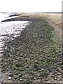
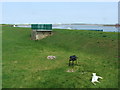
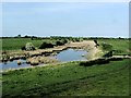
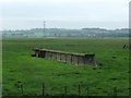
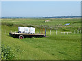
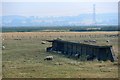
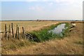
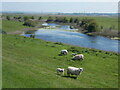
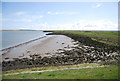
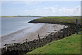
27 photos from this area
Area Information
Key information about the ME9 9HH including its size, population, and administrative classification.
- Area Type
- Postcode
- Area Size
- 1.5 km²
- Population
- 1752
- Population Density
- 64 people/km²
House Prices in ME9 9HH
12
Properties
£451,667
Average Sold Price
£285,000
Lowest Price
£550,000
Highest Price
Showing 12 properties
| Address | Type | Beds | Baths | Last Sale Price | Last Sale Date | |
|---|---|---|---|---|---|---|
| Larkrise, Conyer Road, Teynham, ME9 9HH | Detached | 4 | 2 | £550,000 | Aug 2020 | |
| Conyer Farm, The Moorings, Conyer, ME9 9HH | Detached | 4 | 2 | £520,000 | Mar 2017 | |
| 1, Coastguard Cottages, Conyer Road, Teynham, ME9 9HH | Terraced | 3 | 2 | £285,000 | Mar 2017 | |
| 2, Coastguard Cottages, Conyer Road, Teynham, ME9 9HH | Terraced | 4 | 2 | - | - | |
| 5, Coastguard Cottages, Conyer Road, Teynham, ME9 9HH | Terraced | 4 | 2 | - | - | |
| 3, Coastguard Cottages, Conyer Road, Teynham, ME9 9HH | Terraced | 4 | 2 | - | - | |
| Unit 7, Conyer Farm Estate, Conyer Road, Teynham, ME9 9HH | Industrial | - | - | - | - | |
| Unit 5, Conyer Farm Estate, Conyer Road, Teynham, ME9 9HH | Industrial | - | - | - | - | |
| Southeast Storage Equipment, Unit 4, Conyer Farm Estate, Conyer Road, Teynham, ME9 9HH | warehouse | - | - | - | - | |
| Smart-tech Kent Ltd, Unit 3, Conyer Farm Estate, Conyer Road, Teynham, ME9 9HH | Industrial | - | - | - | - |
Page 1 of 2
Energy Efficiency in ME9 9HH
Amenities
Schools
| Rank | School | Type | Entry gender | Ages |
|---|
Explore more schools in this area
Go to Schools tabDemographics
Household Size
Two person
most common
Accommodation Type
Houses
most common
Tenure
71
majority
Ethnic Group
White
most common
Religion
N/A
most common
Household Composition
N/A
most common
Age
47
median
Adults (30-64 years)
most common
Household Deprivation
N/A
with no deprivation
NS-SEC
35
in Lower managerial occupations
Explore more demographic insights in this area
Go to Demographics tabPlanning
Planning Constraints
- Flood RiskPremium
- Ramsar Wetland SitesPremium
- Area of Outstanding Natural BeautyPremium
- Protected Nature ReservePremium
- Protected WoodlandPremium