Area Overview for ME9 8ST
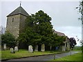
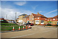
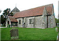
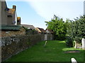
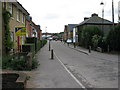
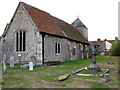
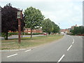
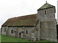
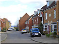
Photos of ME9 8ST


Area Information
ME9 8ST is a small, tightly knit residential area in England, covering just 3.6 hectares and home to 1937 residents. Its compact size means it is a quiet, low-density neighbourhood where most properties are houses rather than flats. The population, predominantly adults aged 30–64, reflects a mature community with strong home ownership—82% of residents own their homes. Daily life here is shaped by proximity to nearby amenities, including five rail stations and a range of retail outlets. While the area lacks large-scale infrastructure, its practical reach includes essential services such as schools and supermarkets. The median age of 47 suggests a stable, established population, with a focus on family living. However, the area carries a medium flood risk, a factor prospective buyers should consider. For those seeking a peaceful, community-oriented environment with access to key services, ME9 8ST offers a blend of practicality and local charm.
- Area Type
- Postcode
- Area Size
- 3.6 hectares
- Population
- 1937
- Population Density
- 196 people/km²
ME9 8ST is primarily an owner-occupied area, with 82% of residents owning their homes. The housing stock is dominated by houses rather than flats, which is typical of smaller, residential clusters. Given the area’s compact size of 3.6 hectares, the property market is limited in scale, with a focus on individual homes rather than larger developments. This suggests a low-density, perhaps rural or semi-rural setting where housing is likely to be spacious but not abundant. For buyers, the high home ownership rate indicates a stable market with little pressure from rental demand. However, the small area size means there are few properties available, and proximity to amenities such as schools and rail stations may be a key selling point. Those considering ME9 8ST should evaluate the balance between property availability and the area’s practical reach for daily needs.
House Prices in ME9 8ST
Showing 23 properties
| Address | Type | Beds | Baths | Last Sale Price | Last Sale Date | |
|---|---|---|---|---|---|---|
| 1 Woodpecker Drive, Iwade, ME9 8ST | Detached | 4 | 2 | £522,500 | May 2025 | |
| 22 Woodpecker Drive, Iwade, ME9 8ST | house | 5 | 2 | £333,000 | Feb 2019 | |
| 23 Woodpecker Drive, Iwade, ME9 8ST | house | 3 | - | £290,000 | May 2018 | |
| 13 Woodpecker Drive, Iwade, ME9 8ST | Semi-detached | 3 | - | £262,500 | Nov 2017 | |
| 21 Woodpecker Drive, Iwade, ME9 8ST | Detached | 4 | 2 | £345,000 | Nov 2016 | |
| 7 Woodpecker Drive, Iwade, ME9 8ST | Detached | 4 | - | £433,000 | Oct 2016 | |
| 5 Woodpecker Drive, Iwade, ME9 8ST | Detached | 4 | - | £290,000 | Mar 2015 | |
| 2 Woodpecker Drive, Iwade, ME9 8ST | Detached | 4 | 3 | £295,000 | Feb 2014 | |
| 15 Woodpecker Drive, Iwade, ME9 8ST | house | 3 | - | £89,000 | Jan 2014 | |
| 8 Woodpecker Drive, Iwade, ME9 8ST | house | 4 | - | £265,000 | Jun 2013 |
Energy Efficiency in ME9 8ST
The lifestyle in ME9 8ST is shaped by its proximity to essential amenities and a modest, community-focused environment. Within practical reach, residents can access five rail stations, including Kemsley and Sittingbourne, which connect to wider transport networks. Retail options include major supermarkets like Asda and Tesco, providing convenience for shopping and daily needs. While the area lacks large parks or leisure facilities, its compact size ensures that essential services are close by, reducing the need for long commutes. The presence of two schools nearby further enhances its appeal for families. The character of ME9 8ST is defined by its quiet, residential nature, with a focus on practicality over luxury. For those valuing accessibility to key services without the bustle of larger towns, this area offers a straightforward, functional lifestyle.
Amenities
Schools
Residents of ME9 8ST have access to two schools within practical reach: Iwade Community Primary School, which provides primary education, and Iwade School, an academy offering secondary-level instruction. These institutions cater to different stages of a child’s education, ensuring families can find both primary and secondary schooling in the immediate vicinity. The presence of a primary school suggests the area is well-suited for families with younger children, while the academy model may indicate a focus on structured or specialist education. Although no Ofsted ratings are provided, the availability of both school types offers a comprehensive educational pathway. For homebuyers prioritising schools, ME9 8ST’s proximity to these institutions is a notable advantage, reducing the need for long commutes to other areas.
| Rank | School | Type | Entry gender | Ages |
|---|
Explore more schools in this area
Go to Schools tabDemographics
The population of ME9 8ST is predominantly adults aged 30–64, with a median age of 47. This suggests a mature, established community with a strong presence of middle-aged residents. Home ownership is high at 82%, indicating a stable housing market where most residents live in their own homes. The area is composed largely of houses rather than flats, reflecting a traditional suburban or rural layout. The predominant ethnic group is White, though no specific data on diversity or deprivation is provided. The age profile and home ownership rate imply a relatively low turnover of residents, with families and long-term occupants forming the core of the community. For buyers, this demographic profile may suggest a neighbourhood with a consistent, low-maintenance housing stock and a focus on long-term residency over short-term rental markets.
Household Size
Accommodation Type
Tenure
Ethnic Group
Religion
Household Composition
Age
Household Deprivation
NS-SEC
Explore more demographic insights in this area
Go to Demographics tabPlanning
Planning Constraints
- Flood RiskPremium
- Ramsar Wetland SitesPremium
- Area of Outstanding Natural BeautyPremium
- Protected Nature ReservePremium
- Protected WoodlandPremium